The Autel Evo Max 4T quadcopter is a groundbreaking tool packed with advanced technology and autonomous capabilities, perfect for professionals. At CARDIAGTECH.NET, we understand the need for reliable, cutting-edge equipment. Discover how the Autel Evo Max 4T drone can transform your operations with enhanced safety, accuracy, and efficiency. This comprehensive guide covers everything from autonomous features to practical applications, helping you maximize your investment and stay ahead of the competition.
1. Understanding the Autel Evo Max 4T Quadcopter
The Autel Evo Max 4T quadcopter is designed to bring powerful technologies and advanced autonomy to users. It’s built to assess complex environments, creating real-time 3D flight paths for unparalleled obstacle avoidance. Advanced sensors enable flight in GPS-unavailable areas, and its new thermal payload unlocks object identification and tracking scenarios. Its foldable, weather-resistant design ensures it’s portable and capable, making it an indispensable tool for various industries. This drone combines robust performance with user-friendly features, making it an ideal investment for professionals who demand the best.
1.1. Key Features of the Autel Evo Max 4T
The Autel Evo Max 4T is loaded with features designed to tackle the most challenging tasks. These include:
- Autonomous Path Finding: Plans 3D flight paths in complex environments.
- GPS-Denied Navigation: Operates in areas where GPS is unavailable.
- Accurate Object Identification: Uses AI for identifying and tracking targets.
- Ultimate Obstacle Avoidance: Combines binocular vision and millimeter wave radar.
- Anti-Jamming and Anti-Interference: Designed to counter RFI, EMI, and GPS spoofing.
- Weather Resistance: IP43 rating for operation in various weather conditions.
- A-Mesh 1.0 Networking: Enables drone-to-drone communication and collaboration.
- Autel SkyLink 3.0: Provides advanced flight capabilities with long-range transmission.
- Mission-Ready Payload: Integrates wide-angle, zoom, and thermal cameras with a laser rangefinder.
- Autel Enterprise App Platform: Features a user-friendly interface with semi-autonomous modes.
- Smart Features: Includes 3D map planning, quick missions, and mission reproduction.
- Multiple Mission Types: Supports rectangular, automatic, and waypoint missions.
- Data Security: Offers privacy protection and encrypted data storage.
- Enhanced Live-View: Multi-channel projection screen and AR scene capabilities.
- Autel SDK: Open SDK for developers to create custom applications.
These features make the Autel Evo Max 4T a versatile and powerful tool for various applications, improving efficiency and accuracy while ensuring operational safety.
1.2. Intended Search Intentions of Target Audience
Understanding what potential users are searching for helps tailor content to meet their needs. Here are five key search intentions related to the Autel Evo Max 4T:
- Detailed Product Information: Users seek comprehensive specifications, features, and capabilities of the Autel Evo Max 4T.
- Professional Applications: Professionals want to know how the drone can be used in their specific industry, such as inspections, surveying, or public safety.
- Purchase Options: Users are looking for where to buy the drone, including pricing, availability, and package deals.
- Comparison with Competitors: Buyers often compare the Autel Evo Max 4T with other high-end drones to ensure they’re making the right choice.
- Technical Support and Training: Users need resources for setup, operation, troubleshooting, and maximizing the drone’s potential.
By addressing these search intentions, we can provide valuable information that assists users in making informed decisions and leveraging the full capabilities of the Autel Evo Max 4T.
2. Autonomous Capabilities of the Autel Evo Max 4T
The Autel Evo Max 4T stands out with its advanced autonomous features. These capabilities are designed to enhance efficiency, safety, and accuracy in various applications. Let’s explore these features in detail:
2.1. Autonomous Path Finding
Autel’s Autonomy Engine collects environmental data and plans 3D flight paths through complex environments such as mountains, forests, and buildings. This feature is beneficial for:
- Rapid 3D Scene Reconstruction: Quickly creates detailed 3D models of environments.
- Public Safety Overwatch: Provides real-time situational awareness for emergency responders.
- Industrial Inspection: Allows for automated inspection of structures and infrastructure.
- Land Surveying: Efficiently maps and surveys land areas with high precision.
This technology drastically reduces the need for manual control, allowing the drone to navigate safely and efficiently through challenging terrains.
 Autonomous Path Finding
2.2. Navigation in GPS-Denied Environments
The Autel Evo Max 4T can navigate within hardened structures, underground, or in environments without GPS, thanks to its advanced sensors. This capability is crucial for:
- Indoor Inspections: Inspecting interior spaces of buildings or facilities.
- Underground Operations: Navigating tunnels or mines where GPS is unavailable.
- Urban Environments: Flying in dense urban areas with limited GPS signal.
Operating in GPS-denied environments expands the drone’s usability, making it a valuable tool in situations where traditional drones would be ineffective.
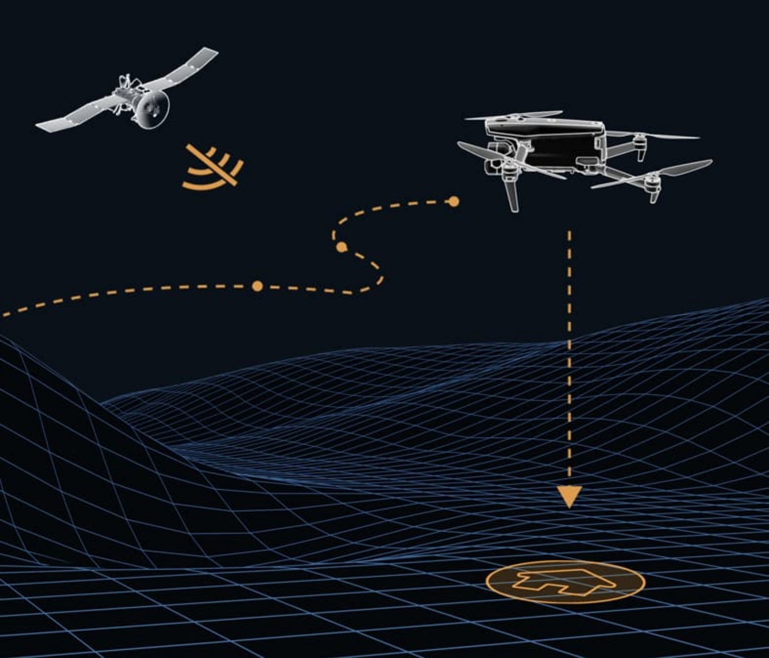 GPS Denied Navigation
2.3. Accurate Object Identification and Tracking
Based on Autel’s AI recognition technology, the EVO Max 4T can automatically identify and lock onto different types of targets such as heat sources, moving people, or vehicles and achieve high-altitude tracking and data collection for law enforcement. This is particularly useful for:
- Search and Rescue: Locating individuals in emergency situations.
- Law Enforcement: Tracking vehicles or individuals for surveillance.
- Wildlife Monitoring: Observing and tracking animal populations without disturbance.
The AI-powered object identification and tracking capabilities enhance the drone’s ability to gather critical data and respond effectively in dynamic environments.
![]() Object Tracking
Object Tracking
3. Unparalleled Obstacle Avoidance System
The Autel Evo Max 4T integrates advanced obstacle avoidance technology, ensuring safer and more reliable flights in complex environments.
3.1. No Blind Spots with Millimeter Wave Radar
The EVO Max 4T is the only commercial drone that combines traditional binocular vision systems with millimeter wave radar technology. This allows the onboard Autel Autonomy Engine to perceive objects down to 0.5 inch, eliminating blind spots and enabling operation in low light or rainy conditions. This leads to:
- Enhanced Safety: Reduces the risk of collisions with obstacles.
- Reliable Operation: Ensures consistent performance in various lighting and weather conditions.
- Precise Navigation: Allows for accurate maneuvering in tight spaces.
This combination of technologies provides a comprehensive obstacle avoidance system, making the Autel Evo Max 4T a safer and more reliable choice for professional applications.
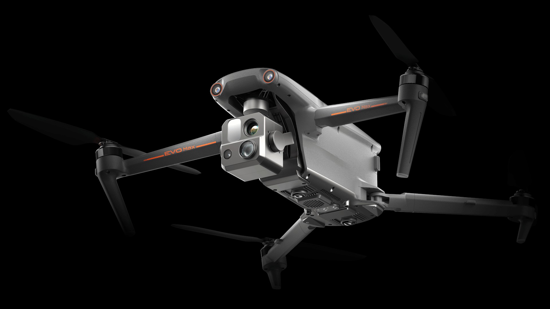 No Blind Spots 1
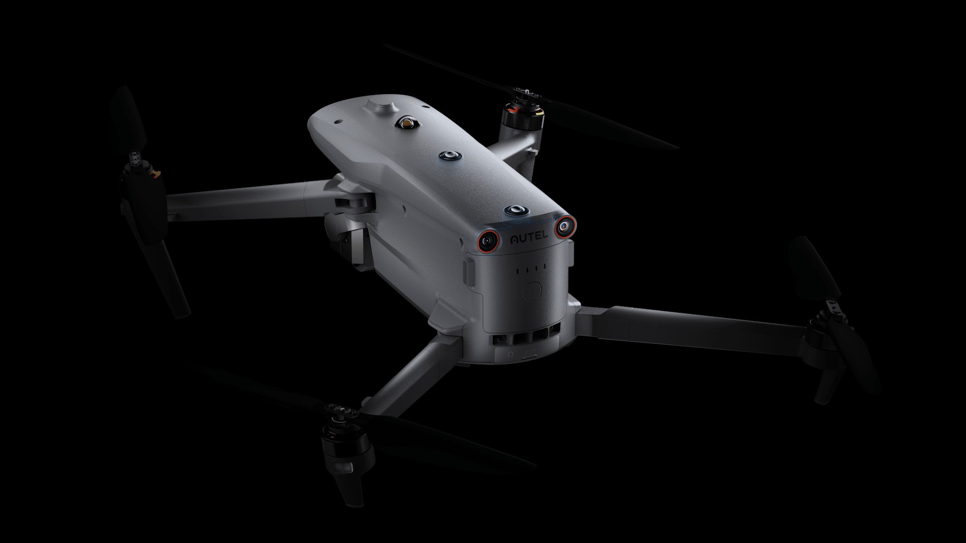 No Blind Spots 2
4. Enhanced Reliability and Connectivity
The Autel Evo Max 4T is built to perform reliably even in challenging environments. Its anti-jamming capabilities and advanced networking technology ensure stable and consistent operation.
4.1. Anti-Jamming and Anti-Interference Features
The EVO Max 4T uses advanced flight control modules and algorithms designed to counter RFI, EMI, and GPS spoofing. This enables the drone to fly confidently near power lines, critical structures, and in complex areas, ensuring:
- Stable Flight: Maintains consistent performance in areas with electromagnetic interference.
- Accurate Positioning: Prevents GPS spoofing, ensuring correct location data.
- Reliable Operation: Reduces the risk of signal loss or interference.
4.2. Weather Resistance
With an IP43 weather rating, the Autel Evo Max 4T can operate in light rain and dusty conditions. This ensures the drone remains operational in a wider range of environments, providing flexibility and reliability for outdoor missions.
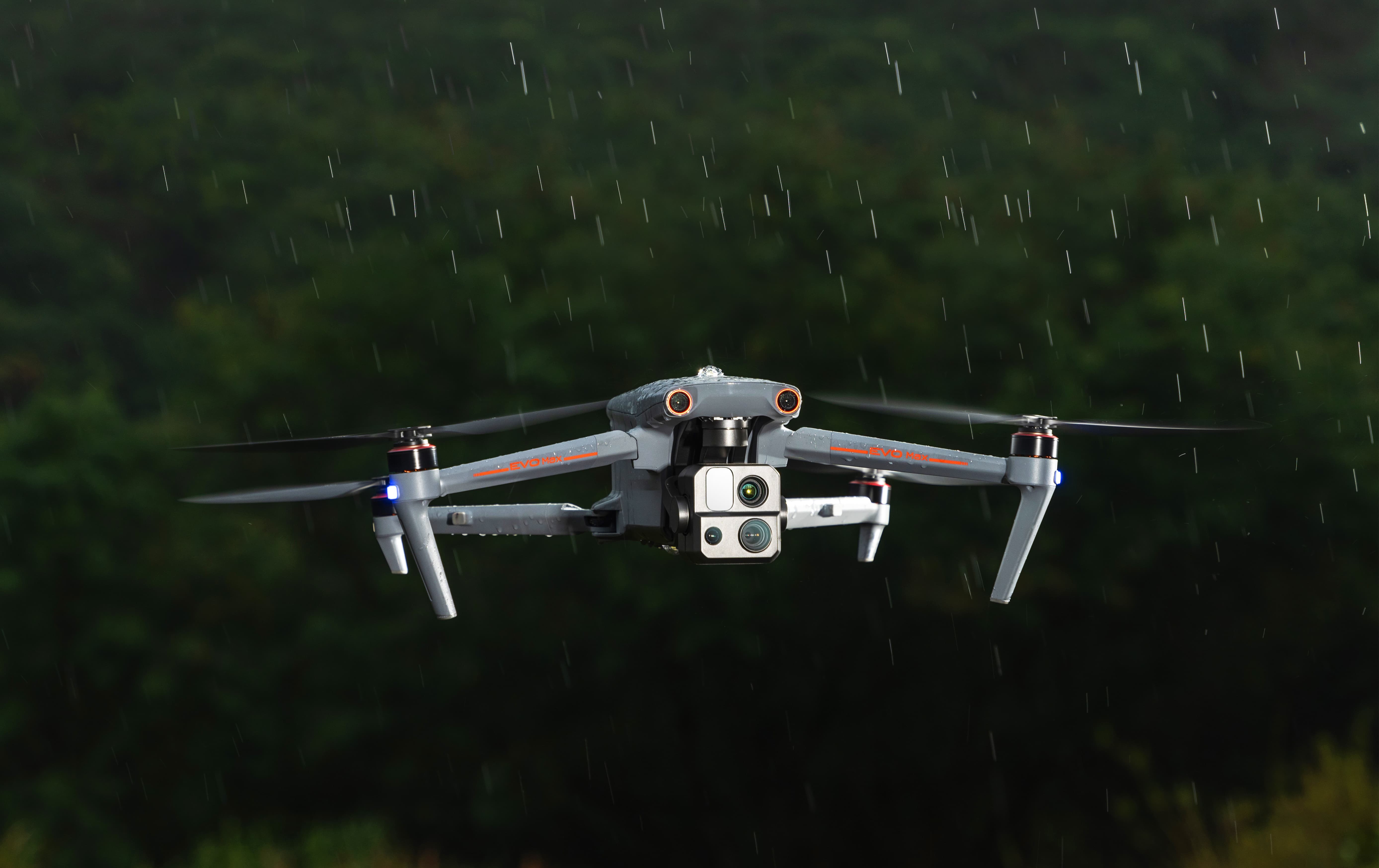 IP43 Rating
4.3. A-Mesh 1.0 Networking Technology
The EVO Max 4T features the new A-Mesh system, enabling drone-to-drone autonomous communication, connection, and collaboration. This offers several advantages:
- Strong Anti-Interference: Communicates seamlessly with other drones, self-organizing if a drone fails.
- Beyond-Line-of-Sight (BVLOS) Applications: Multiple aircraft act as relay points to improve BVLOS operation effectiveness.
- Full-Fleet Control: Multiple drones can be controlled autonomously by one pilot or a group of pilots, with or without LTE coverage.
- Enhanced Range: Communication nodes can be placed statically or mobile to extend coverage.
A-Mesh networking enhances the drone’s operational capabilities, making it ideal for large-scale missions and collaborative projects.
4.4. Autel SkyLink 3.0
The EVO Max 4T SkyLink 3.0 system comes with 6 antennas, 4 frequency bands, AES-256 encryption, and optional 4G integration to provide users with the most advanced flight capabilities. Key benefits include:
- 12.4 Miles Image Transmission Distance: Long-range communication for extended missions.
- 1080p/60fps Real-Time Image Quality: High-resolution video streaming for detailed monitoring.
- 900MHz/2.4GHz/5.2GHz/5.8GHz Frequency Bands: Flexible frequency options to avoid interference.
- Low Latency: Minimal delay in video transmission for real-time control.
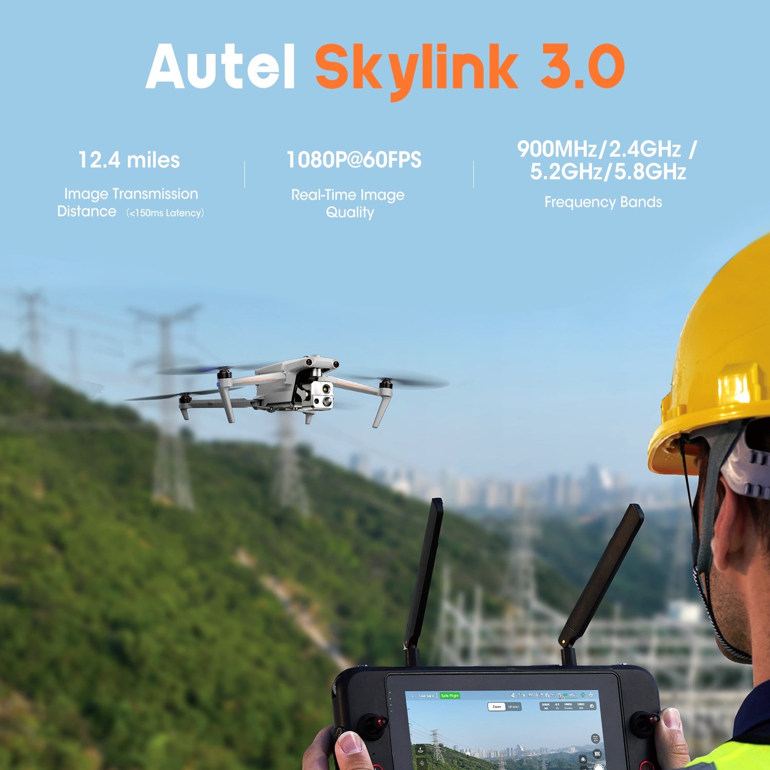 Autel SkyLink 3.0
5. Advanced Payload and Imaging Capabilities
The Autel Evo Max 4T is equipped with a mission-ready payload that integrates multiple cameras and a laser rangefinder, enabling comprehensive data capture and critical decision-making.
5.1. Integrated Camera System
The payload includes:
- Wide Camera: 48MP 1/2″ CMOS, f/2.8 aperture, 83.4° DFOV, 24 mm equivalent.
- Zoom Camera: 48MP, 10x optical zoom, 160x max. hybrid zoom, f/2.8-f/4.8 aperture.
- Thermal Camera: 640×512 resolution, 9.1mm aperture, 16x digital zoom, temperature measurement range of -20°C to 550°C.
- Laser Rangefinder: Measuring range of 5 – 1200m, measurement accuracy of ±1m.
These cameras provide versatile imaging options for various applications, ensuring you capture the necessary data with precision and clarity.
5.2. Practical Applications of the Payload
The integrated payload is ideal for:
- Detailed Inspections: Capturing high-resolution images and thermal data for infrastructure inspections.
- Search and Rescue: Using thermal imaging to locate individuals in low-light conditions.
- Surveying and Mapping: Employing the laser rangefinder for accurate distance measurements and 3D mapping.
- Law Enforcement: Utilizing zoom capabilities for surveillance and evidence gathering.
6. Autel Enterprise App Platform and Smart Features
The Autel Enterprise App is designed for industrial applications, featuring a user-friendly interface and semi-autonomous modes to maximize the Autel Evo Max 4T’s mission capabilities.
6.1. User-Friendly Interface
The app is built from the ground up for simple and efficient operation. It provides easy access to all the drone’s features and settings, allowing users to quickly set up and execute missions.
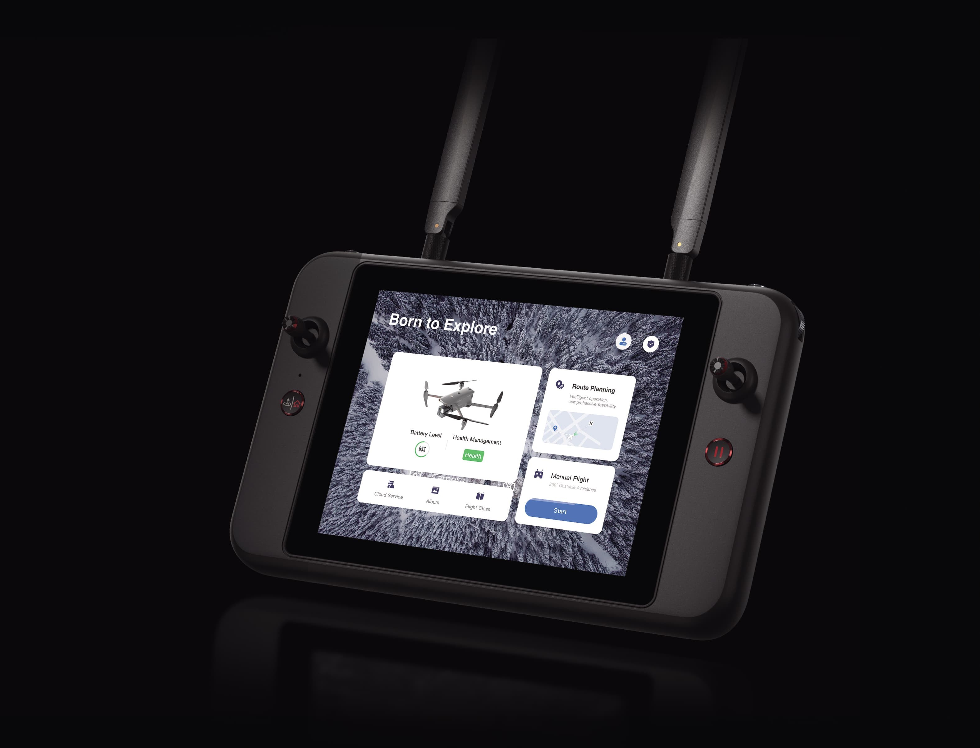 Autel Enterprise App
6.2. Smart Features for Enhanced Mission Capabilities
The Autel Evo Max 4T includes several smart features that enhance its mission capabilities:
- 3D Map Planning: Plan, create, and execute 3D waypoint mission plans on a 3D map.
- Quick Mission: Create temporary quick missions while executing other missions, stacking multiple sub-missions for enhanced flexibility.
- Mission Reproduction: Record camera angles and replicate missions automatically, streamlining repetitive tasks.
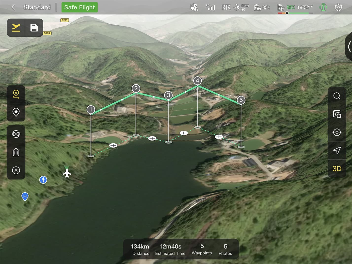 3D Map Planning
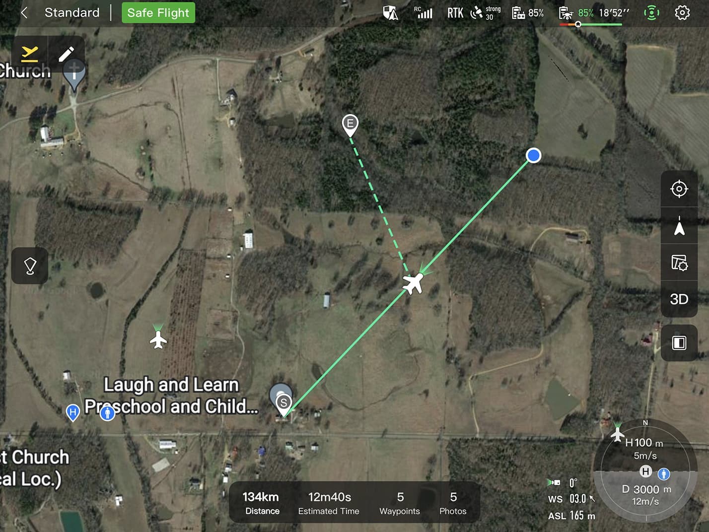 Quick Mission
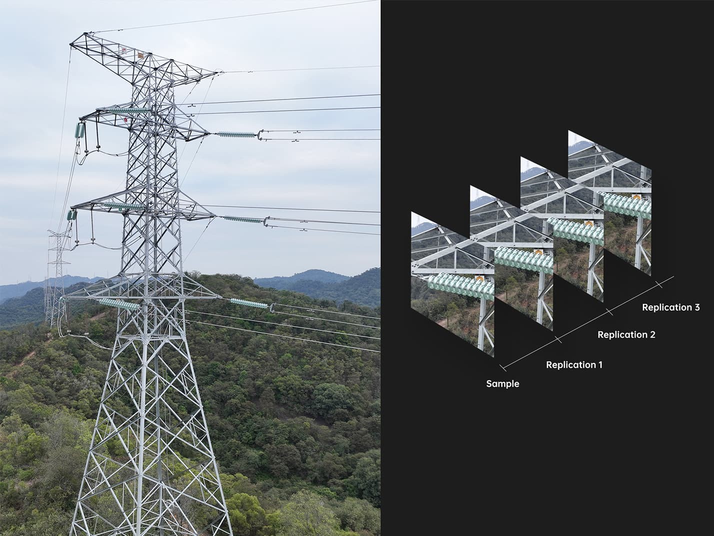 Mission Reproduction
6.3. Multiple Mission Types
The Enterprise App provides various autonomous and semi-autonomous mission planning options for public safety, inspection, and surveying:
- Rectangular Mission: One-click automatic generation of a rectangular flight area.
- Automatic Mission Generation and Data Capture: Automatically produce routes by adding regional boundary points or importing KML files.
- Waypoint Missions: Add waypoints for flexible, non-structured flight paths.
These mission types allow you to tailor the drone’s operation to your specific needs, improving efficiency and accuracy.
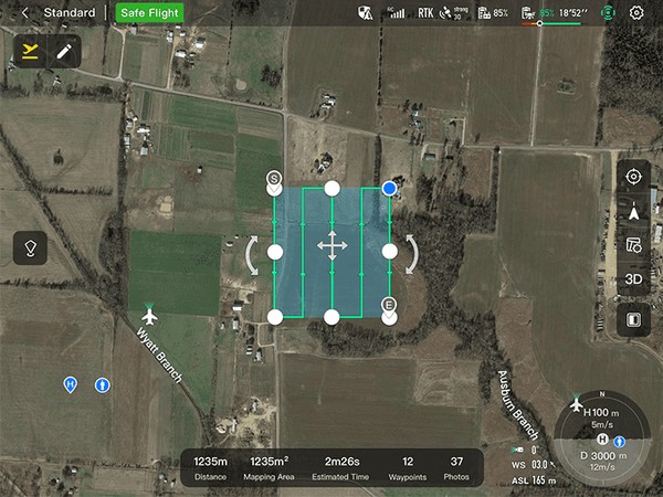 Rectangular Mission
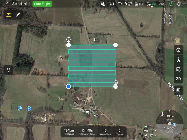 Automatic Mission Generation
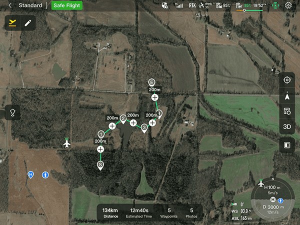 Waypoint Missions
7. Data Security and Enhanced Live-View
The Autel Evo Max 4T prioritizes data security and offers enhanced live-view capabilities, ensuring secure and efficient operations.
7.1. Data Security Features
The Autel Evo Max 4T includes several data security measures:
- Privacy Protection: User and aircraft information, including flight logs, locations, and account information, can only be physically accessed via the aircraft locally.
- Encrypted Data Storage: Supports AES-256 encryption for photos, videos, and flight logs, with password protection.
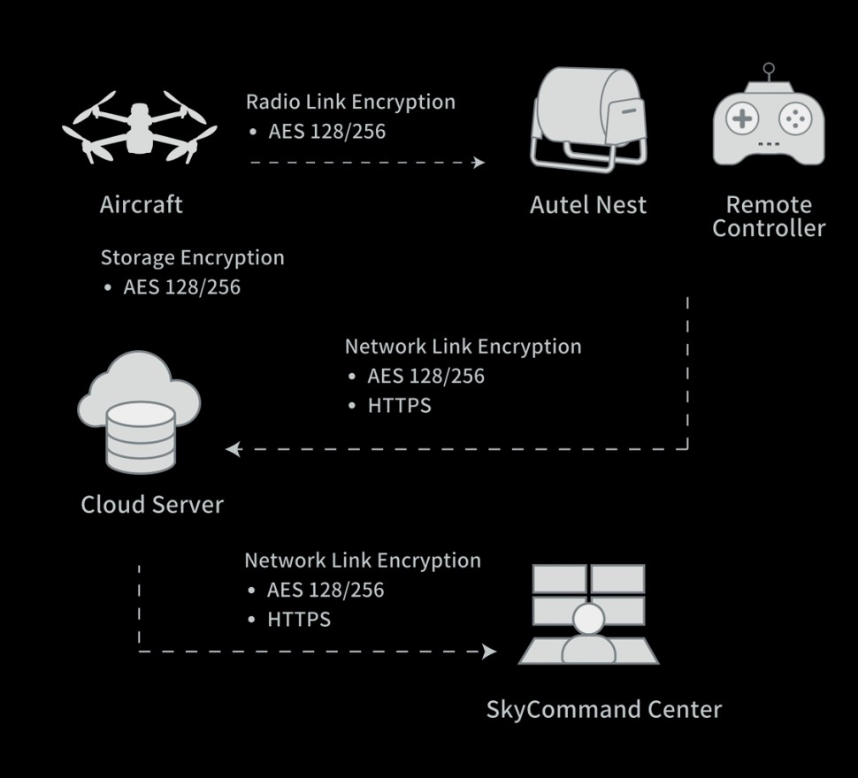 Data Security
These features ensure that sensitive data remains secure, providing peace of mind for users in various industries.
7.2. Enhanced Live-View Capabilities
The Autel Evo Max 4T offers enhanced live-view options:
- Multi-channel Projection Screen: Supports simultaneous output of RGB, infrared, night vision, and wide-angle images.
- AR Scene: Geo-location data and other aircraft location info detected by ADS-B can overlay on a real-time map, helping users confirm the drone’s location and avoid airborne risks.
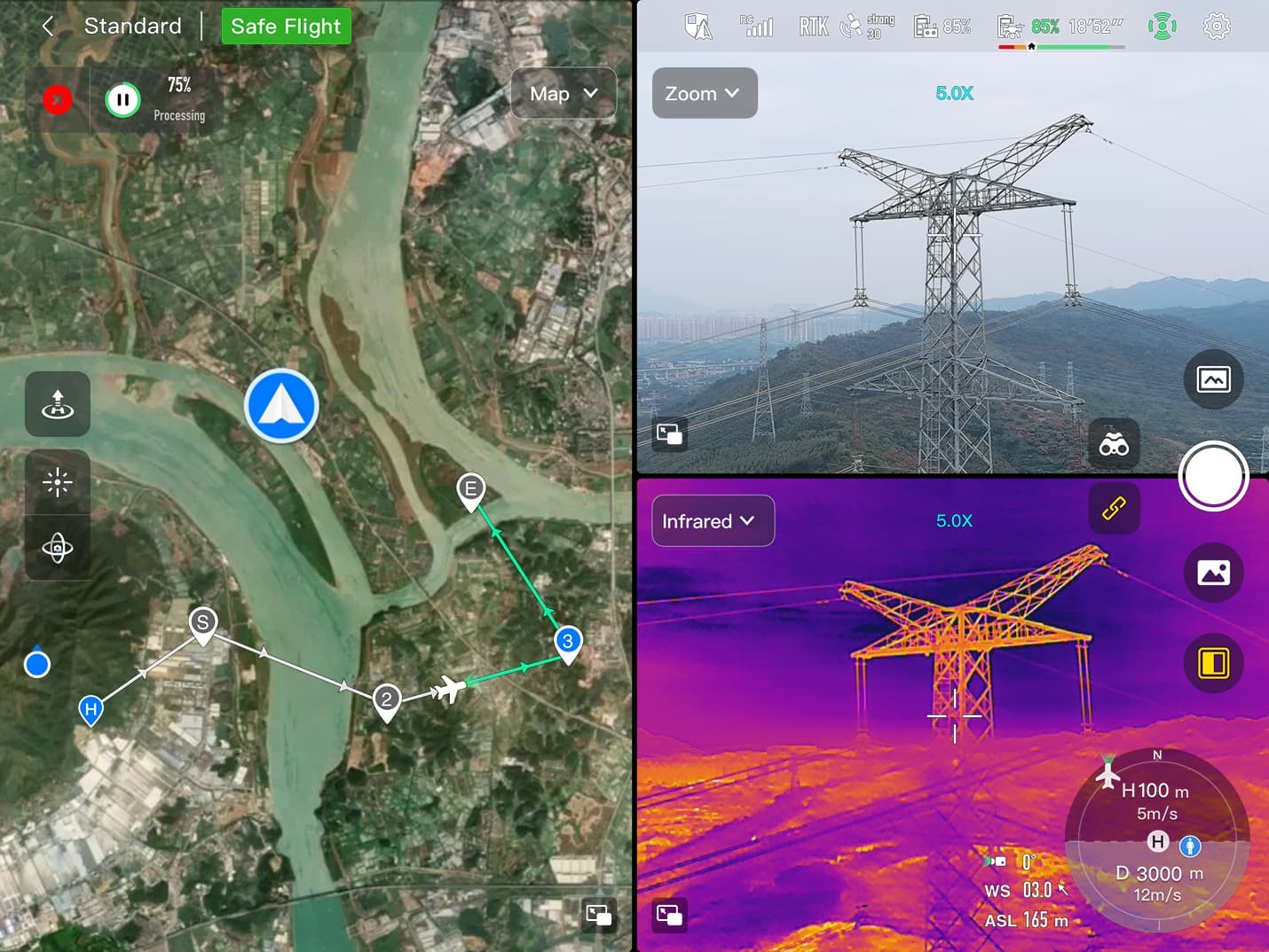 Multi-channel Projection Screen
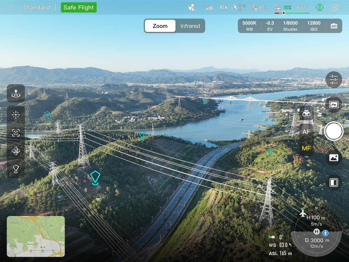 AR Scene
These enhancements provide comprehensive situational awareness, improving the drone’s operational effectiveness.
8. Autel SDK and Wide Applications
The Autel SDK allows developers to create custom applications, expanding the drone’s capabilities. Its wide range of applications makes it a versatile tool for various industries.
8.1. Autel SDK for Custom Applications
The Autel SDK is open to the world, helping developers and partners reduce software and hardware development costs and jointly create a new industry ecosystem. (Note: Only mobile SDK is available at this moment, other 2 not released yet).
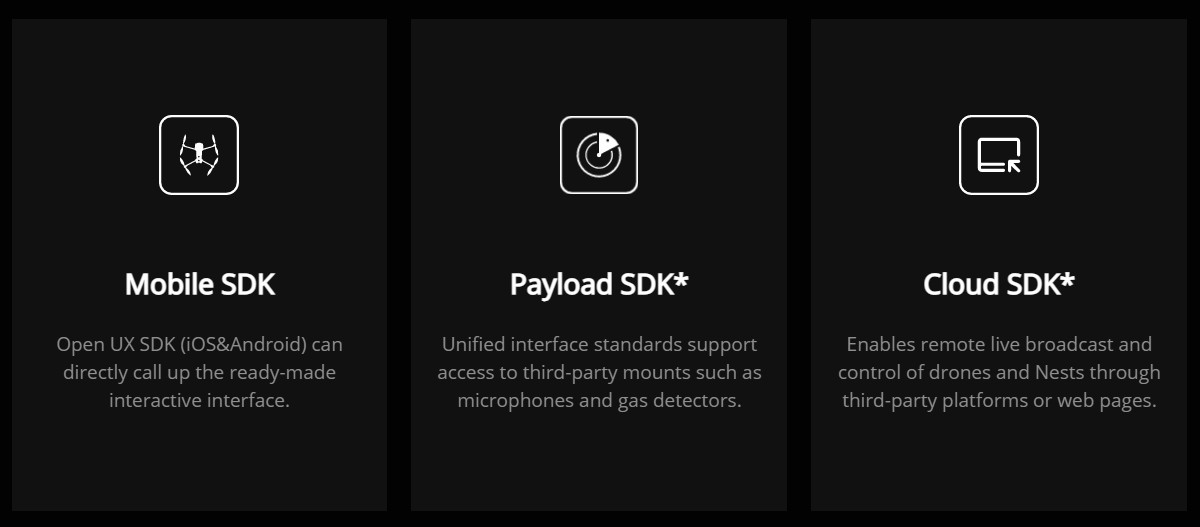 Autel SDK
8.2. Wide Range of Applications
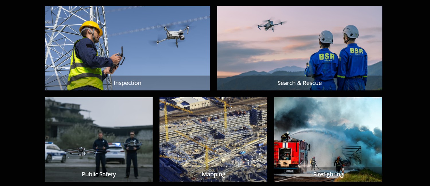
The Autel Evo Max 4T is used in various industries, including:
- Public Safety: Search and rescue, law enforcement, and emergency response.
- Infrastructure Inspection: Bridges, power lines, and telecommunications towers.
- Construction: Site monitoring, progress tracking, and safety inspections.
- Agriculture: Crop monitoring, livestock management, and irrigation planning.
- Environmental Monitoring: Wildlife surveys, pollution tracking, and conservation efforts.
 Autel Applications
9. Addressing Customer Challenges with CARDIAGTECH.NET
At CARDIAGTECH.NET, we understand the challenges faced by professionals in the automotive and related industries. The Autel Evo Max 4T addresses many of these challenges by providing:
- Increased Efficiency: Autonomous features reduce the time required for inspections and surveys.
- Improved Accuracy: High-resolution cameras and laser rangefinders provide precise data.
- Enhanced Safety: Obstacle avoidance and anti-interference technologies minimize risks.
- Versatile Applications: Adaptable to various tasks across multiple industries.
We are committed to providing solutions that enhance your productivity, reduce costs, and improve the quality of your services.
9.1. Call to Action
Ready to elevate your operations with the Autel Evo Max 4T? Contact CARDIAGTECH.NET today for expert advice and support. Our team can help you determine if the Autel Evo Max 4T is the right tool for your specific needs and provide training to ensure you maximize its potential.
Contact us:
- Address: 276 Reock St, City of Orange, NJ 07050, United States
- WhatsApp: +1 (641) 206-8880
- Website: CARDIAGTECH.NET
Don’t miss out on the opportunity to transform your business with the Autel Evo Max 4T. Contact us now to learn more and make your purchase.
10. Specifications and Features Comparison Table
To provide a clearer overview, here’s a detailed table comparing the key specifications and features of the Autel Evo Max 4T:
| Feature | Specification |
|---|---|
| Autonomous Navigation | 3D path planning, GPS-denied navigation |
| Obstacle Avoidance | Binocular vision + millimeter wave radar, 0.5-inch object detection |
| Weather Resistance | IP43 |
| Networking | A-Mesh 1.0 (drone-to-drone communication) |
| Transmission Distance | 12.4 miles (SkyLink 3.0) |
| Video Quality | 1080p/60fps |
| Wide Camera | 48MP 1/2″ CMOS, f/2.8 aperture, 83.4° DFOV, 24 mm equivalent |
| Zoom Camera | 48MP, 10x optical zoom, 160x max. hybrid zoom, f/2.8-f/4.8 aperture |
| Thermal Camera | 640×512 resolution, 9.1mm aperture, 16x digital zoom, -20°C to 550°C temperature range |
| Laser Rangefinder | 5 – 1200m measuring range, ±1m accuracy |
| Data Encryption | AES-256 |
| Application Platform | Autel Enterprise App (3D map planning, quick mission, mission reproduction) |
| Mission Types | Rectangular, automatic, waypoint |
| SDK Availability | Open Autel SDK (mobile SDK available) |
| Anti-Interference | RFI, EMI, GPS spoofing countermeasures |
11. Real-World Applications and Case Studies
To further illustrate the versatility and effectiveness of the Autel Evo Max 4T, let’s explore some real-world applications and potential case studies.
11.1. Public Safety and Law Enforcement
Scenario: Search and Rescue Operation
A hiker is reported missing in a remote, mountainous area. The Autel Evo Max 4T is deployed to assist in the search.
- Challenge: Difficult terrain, limited visibility due to dense forest cover, and the need to quickly locate the missing hiker.
- Solution:
- Autonomous Path Finding: The drone uses its autonomy engine to navigate the complex terrain, avoiding obstacles and planning efficient flight paths.
- Thermal Camera: The thermal camera is used to detect heat signatures, even through dense foliage, to locate the hiker.
- GPS-Denied Navigation: In areas with limited GPS signal, the drone’s advanced sensors ensure continued navigation.
- Outcome: The missing hiker is located within hours, significantly reducing the search time and increasing the chances of survival. The real-time data and thermal imagery provided by the drone enable rescuers to reach the hiker quickly and provide necessary assistance.
11.2. Infrastructure Inspection
Scenario: Bridge Inspection
A major bridge requires a detailed inspection to assess its structural integrity. Traditional methods are time-consuming, costly, and pose safety risks to human inspectors.
- Challenge: Need for a comprehensive inspection of the bridge structure, including hard-to-reach areas, without disrupting traffic flow or endangering personnel.
- Solution:
- High-Resolution Cameras: The drone captures high-resolution images and videos of the bridge structure, allowing for detailed visual inspection.
- Zoom Camera: The zoom camera provides close-up views of critical areas, identifying cracks, corrosion, and other potential issues.
- Stable Flight: The drone’s anti-interference technology ensures stable flight near the bridge’s metal structure, providing clear and accurate data.
- Outcome: The inspection is completed quickly and safely, with minimal disruption to traffic. The detailed imagery allows engineers to identify potential problems early, preventing costly repairs and ensuring the bridge’s long-term structural integrity.
11.3. Construction and Site Monitoring
Scenario: Construction Site Progress Tracking
A large construction project requires regular monitoring to track progress and identify potential delays or issues.
- Challenge: Need for frequent and accurate monitoring of the construction site, including aerial views of the entire area, without incurring significant costs or delays.
- Solution:
- 3D Mapping: The drone creates detailed 3D maps of the construction site, providing an accurate overview of the progress.
- High-Resolution Imagery: The drone captures high-resolution images and videos, allowing project managers to monitor the site closely and identify any issues.
- Mission Reproduction: The drone automatically replicates missions, ensuring consistent data collection over time and streamlining the monitoring process.
- Outcome: Project managers gain real-time insights into the construction progress, enabling them to identify and address potential issues quickly. The detailed data helps optimize resource allocation, minimize delays, and ensure the project stays on track.
12. Frequently Asked Questions (FAQ)
Here are ten frequently asked questions about the Autel Evo Max 4T, designed to provide quick and informative answers:
-
What are the primary uses of the Autel Evo Max 4T?
The Autel Evo Max 4T is primarily used for public safety, infrastructure inspection, construction monitoring, agricultural surveys, and environmental monitoring. -
Can the Autel Evo Max 4T fly in areas without GPS?
Yes, the Autel Evo Max 4T can navigate in GPS-denied environments thanks to its advanced sensors. -
What is the range of the Autel Evo Max 4T’s transmission?
The Autel Evo Max 4T has a transmission range of up to 12.4 miles using the SkyLink 3.0 system. -
What kind of cameras does the Autel Evo Max 4T have?
It integrates a wide-angle camera, a zoom camera, a thermal camera, and a laser rangefinder. -
How does the Autel Evo Max 4T handle obstacle avoidance?
It combines traditional binocular vision systems with millimeter wave radar technology for comprehensive obstacle avoidance. -
Is the Autel Evo Max 4T weather-resistant?
Yes, it has an IP43 weather rating, making it resistant to light rain and dust. -
What is A-Mesh 1.0 technology?
A-Mesh 1.0 is a networking technology that enables drone-to-drone autonomous communication, connection, and collaboration. -
How secure is the data collected by the Autel Evo Max 4T?
The Autel Evo Max 4T supports AES-256 encryption for photos, videos, and flight logs and offers privacy protection for user and aircraft information. -
Is there an SDK available for the Autel Evo Max 4T?
Yes, the Autel SDK is open, allowing developers to create custom applications. -
Where can I purchase the Autel Evo Max 4T?
You can purchase the Autel Evo Max 4T at CARDIAGTECH.NET, where you can also receive expert advice and support.
13. Final Thoughts on the Autel Evo Max 4T
The Autel Evo Max 4T квадрокоптер is a cutting-edge tool designed for professionals who demand the best in performance, reliability, and versatility. Its advanced features, including autonomous navigation, superior obstacle avoidance, and high-quality imaging capabilities, make it an ideal solution for a wide range of applications. Whether you’re in public safety, infrastructure inspection, construction, or agriculture, the Autel Evo Max 4T offers the tools you need to enhance your operations and achieve superior results. At CARDIAGTECH.NET, we are proud to offer this exceptional product, backed by our expert support and commitment to customer satisfaction. Contact us today to learn more about how the Autel Evo Max 4T can transform your business.
