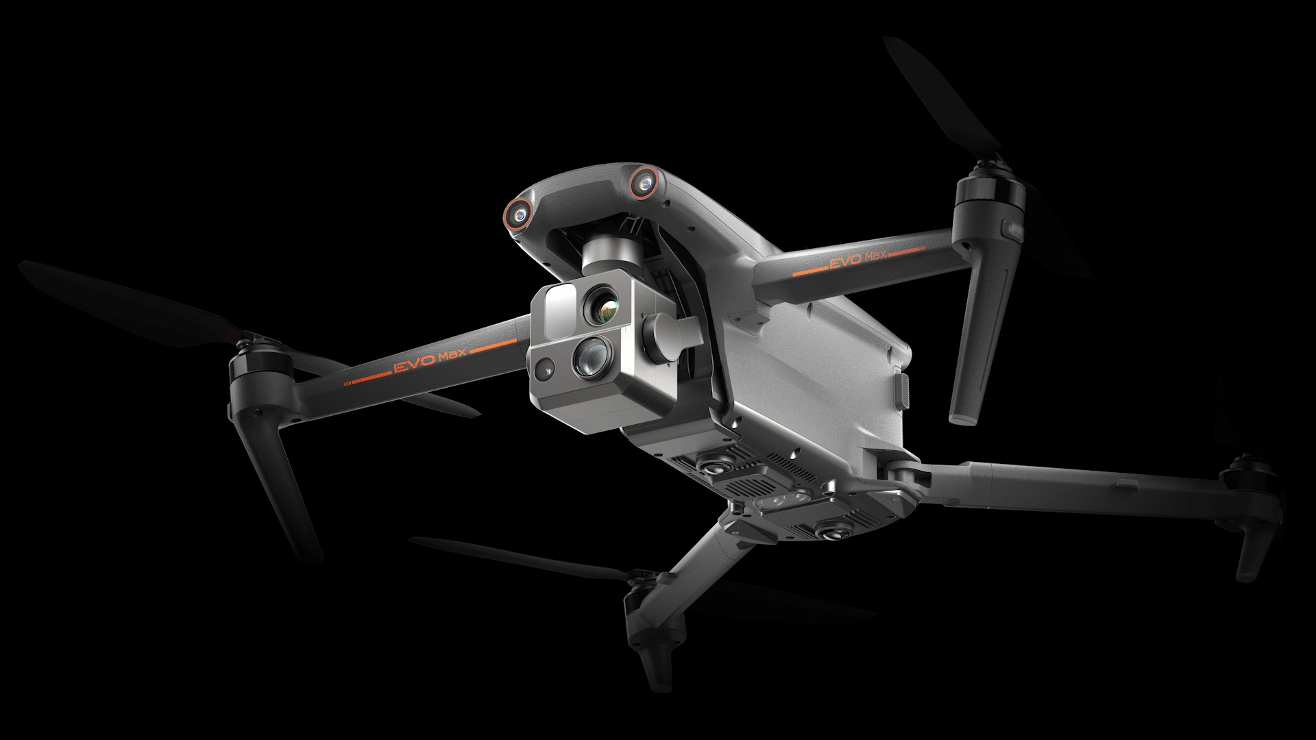
The Autel EVO Max 4T specs represent a significant leap forward in commercial drone technology, offering advanced capabilities for various industrial applications. CARDIAGTECH.NET is your premier source for the EVO Max 4T, providing expert insights and access to this cutting-edge drone. Explore the specifications, features, and benefits of the Autel EVO Max 4T for your specific needs, including detailed specifications, autonomous capabilities, and advanced imaging systems.
1. Introduction to Autel EVO Max 4T
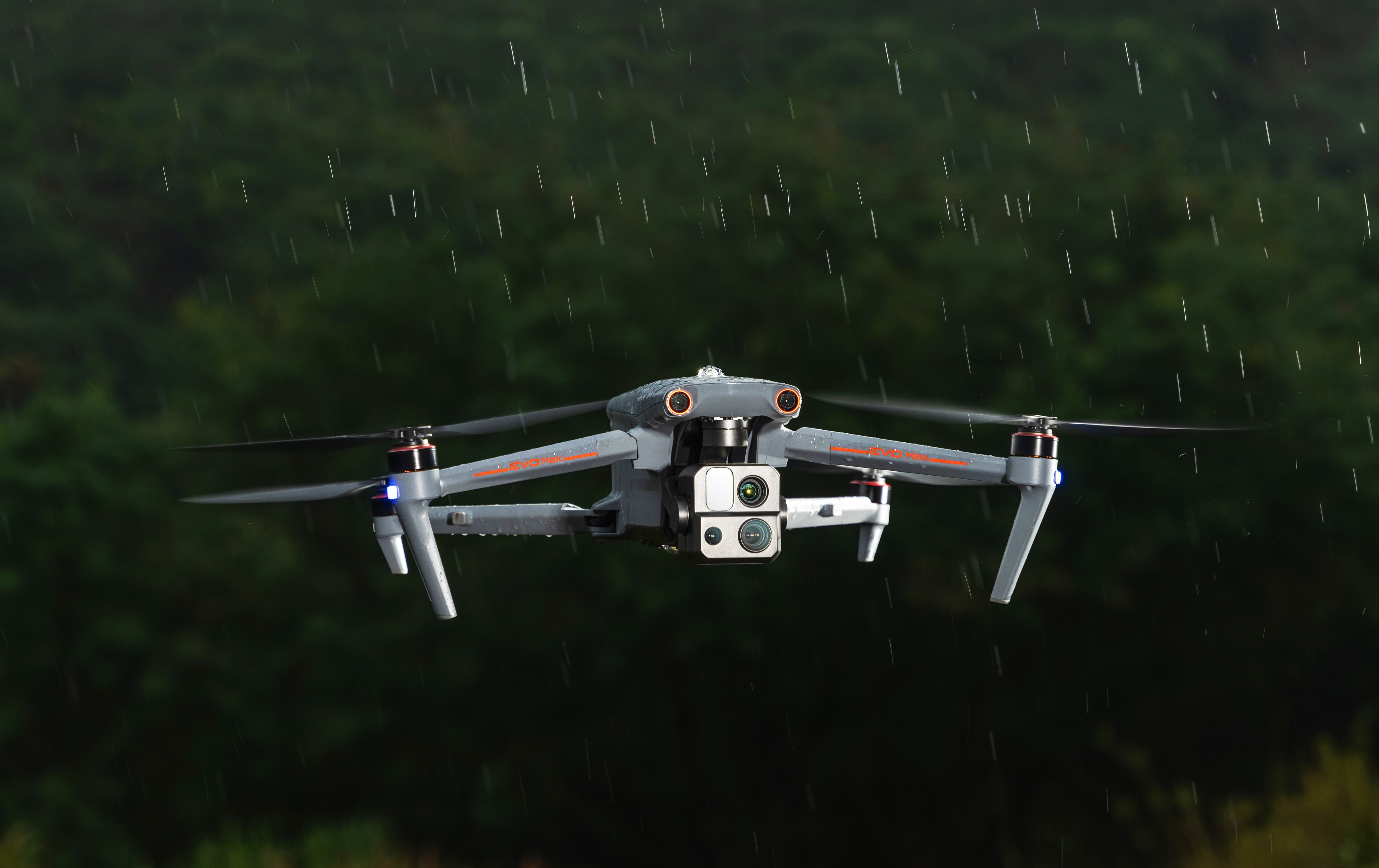
The Autel EVO Max 4T is designed to provide users with powerful technologies and advanced autonomy, making it a top choice for complex environments. This drone is engineered to assess surroundings and generate real-time 3D flight paths, offering unparalleled obstacle avoidance. Its advanced sensors enable flight in GPS-denied areas, while its thermal payload unlocks new object identification and tracking capabilities. The foldable, weather-resistant design ensures that the EVO Max 4T is both portable and capable. It’s a versatile tool suitable for various applications, from industrial inspections to public safety operations, and CARDIAGTECH.NET can help you integrate it into your workflow.
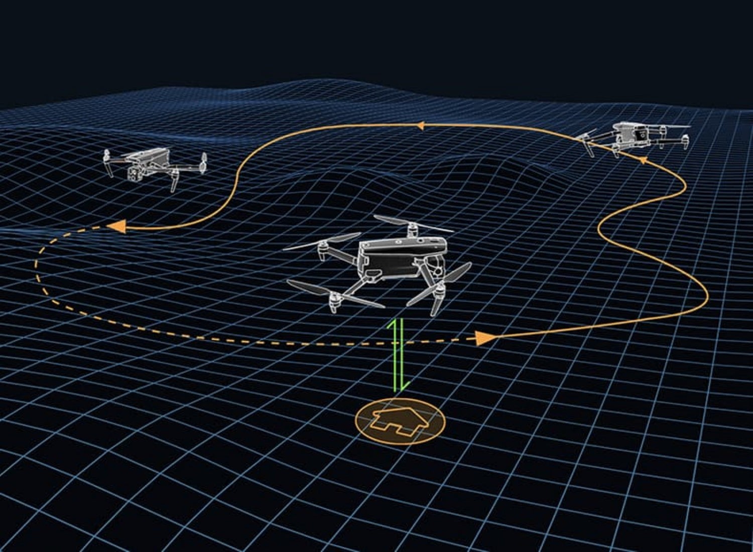
2. Autonomous Path Finding
Autel’s Autonomy Engine collects surrounding environmental data to plan 3D flight paths through complex environments such as mountains, forests, and buildings. This feature is crucial for rapid 3D scene reconstruction, public safety overwatch, industrial inspection, and land surveying. The EVO Max 4T’s autonomous pathfinding capabilities ensure efficient and safe navigation, even in challenging terrains.
2.1 How Autonomy Engine Works
The Autonomy Engine integrates data from multiple sensors to create a comprehensive understanding of the environment. It then uses sophisticated algorithms to generate optimized flight paths that avoid obstacles and ensure mission success. This technology minimizes the need for manual control, allowing operators to focus on data collection and analysis.
2.2 Use Cases for Autonomous Path Finding
Autonomous path finding is invaluable in scenarios where manual flight is difficult or dangerous. For example, during search and rescue missions, the EVO Max 4T can autonomously navigate through forests and mountainous regions to locate missing persons. In industrial inspections, it can efficiently map and inspect structures, identifying potential issues without human intervention.
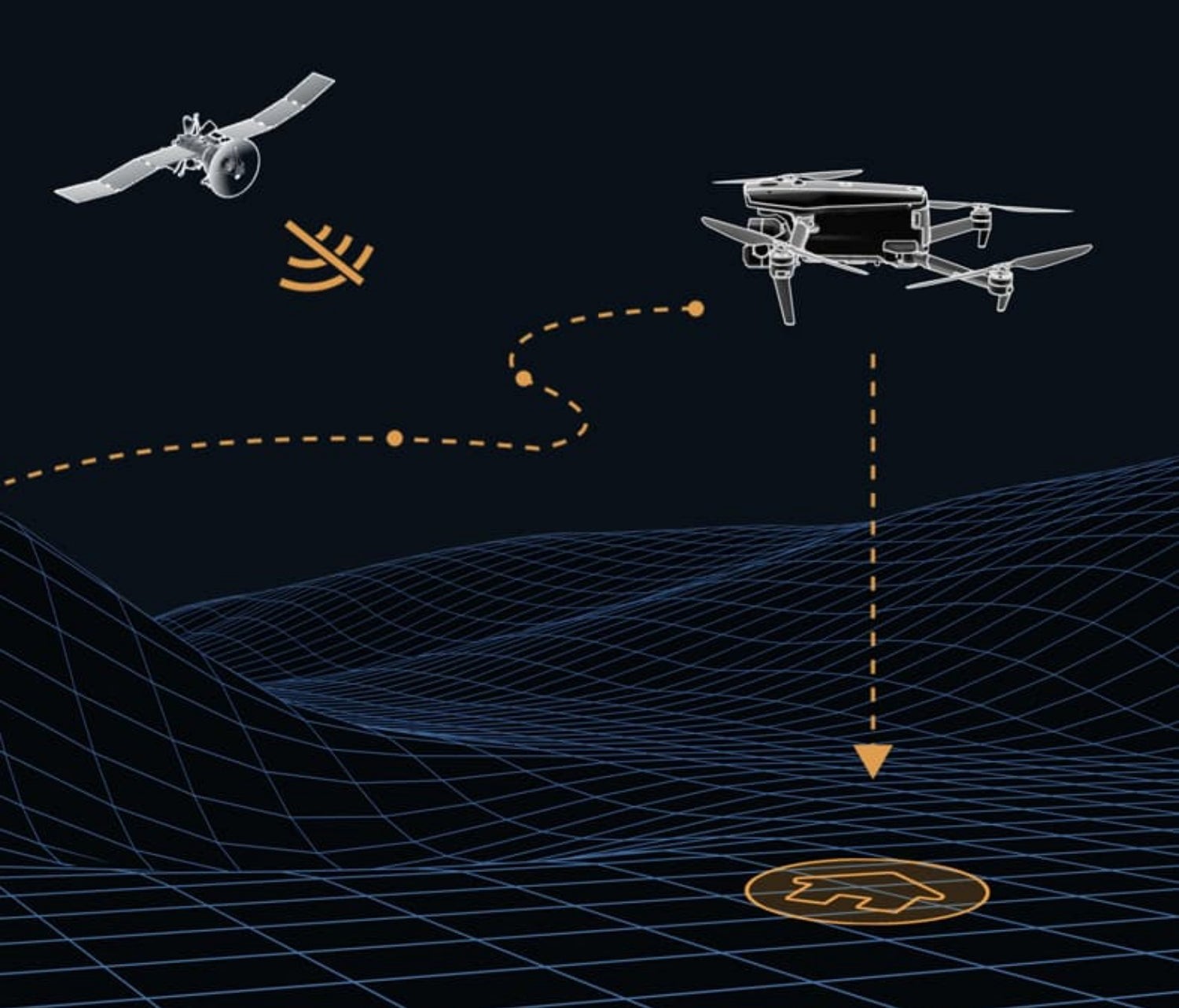
3. Navigation in GPS-Denied Environments
Advanced sensors allow the EVO Max 4T to navigate within hardened structures, underground, or in environments without GPS. This capability is essential for missions in areas where GPS signals are unreliable or unavailable. The drone’s robust navigation system ensures consistent performance in any environment.
3.1 Sensor Technology
The EVO Max 4T utilizes a suite of sensors, including visual sensors, inertial measurement units (IMUs), and radar, to maintain accurate positioning and navigation in GPS-denied environments. These sensors work together to provide a reliable and precise navigation solution.
3.2 Applications in GPS-Denied Areas
Navigation in GPS-denied areas is critical for inspecting underground mines, navigating inside buildings, and operating in environments with significant electromagnetic interference. The EVO Max 4T’s capabilities make it suitable for these challenging scenarios, providing valuable data and insights.
4. Accurate Object Identification and Tracking
Based on Autel’s AI recognition technology, the EVO Max 4T can automatically identify and lock onto different types of targets such as heat sources, moving people, or vehicles. It achieves high-altitude tracking and data collection for law enforcement, making it an invaluable tool for surveillance and security operations.
4.1 AI-Powered Recognition
The EVO Max 4T’s AI recognition technology enables it to distinguish between various objects and prioritize targets based on predefined criteria. This feature enhances the drone’s ability to provide actionable intelligence in real-time.
4.2 Law Enforcement Applications
In law enforcement, the EVO Max 4T can be used to track suspects, monitor crowds, and assess emergency situations from a safe distance. Its ability to identify and track targets enhances situational awareness and improves response times.
5. No Blind Spots – Ultimate Obstacle Avoidance
The EVO Max 4T stands out as the only commercial drone that combines traditional binocular vision systems with millimeter-wave radar technology. This combination allows the Autel Autonomy Engine to perceive objects down to 0.5 inch, eliminating blind spots and enabling operation in low light or rainy conditions. This comprehensive obstacle avoidance system ensures safer and more reliable flights, even in challenging environments.
5.1 Fusion of Vision and Radar
The integration of binocular vision and millimeter-wave radar provides a redundant and highly accurate obstacle detection system. While vision systems excel in clear conditions, radar can penetrate fog, smoke, and darkness, ensuring consistent performance in all weather conditions.
5.2 Operational Benefits
The ability to operate in low light and rainy conditions expands the operational window for the EVO Max 4T. This is particularly valuable for applications such as nighttime security patrols, infrastructure inspections in adverse weather, and search and rescue missions where time is of the essence.
6. Anti-Jam and Anti-Interference
The EVO Max 4T uses advanced flight control modules and algorithms specially designed to counter RFI, EMI, and GPS spoofing. This enables the EVO Max 4T to fly confidently near power lines, critical structures, and in complex areas, ensuring stable and reliable performance in challenging electromagnetic environments.
6.1 Countermeasures Against Interference
The drone’s anti-interference technology includes shielding, filtering, and advanced signal processing techniques. These measures minimize the impact of external interference on flight control and navigation systems, ensuring stable and reliable performance.
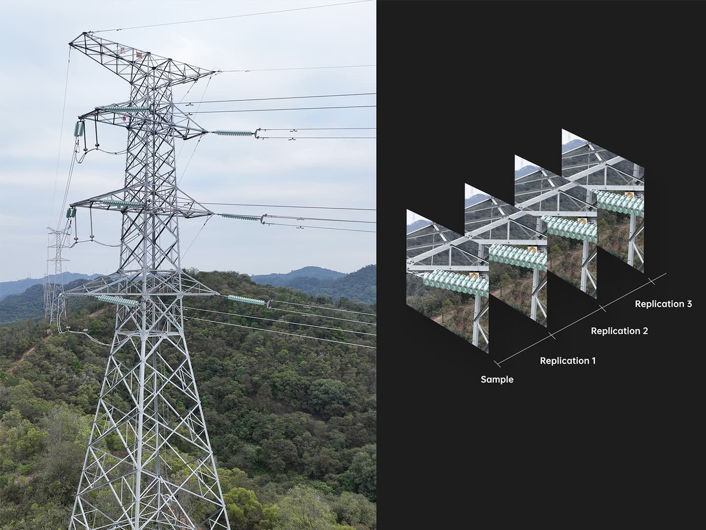
6.2 Applications in High-Interference Areas
The EVO Max 4T’s anti-jamming capabilities are essential for inspecting power lines, bridges, and other critical infrastructure in urban areas. These environments are often subject to high levels of electromagnetic interference, which can disrupt the operation of less robust drones.
7. Weather Rating – IP43
The EVO Max 4T boasts an IP43 weather rating, indicating its resistance to water spray and solid objects. This rating ensures reliable performance in light rain and dusty conditions, making it suitable for outdoor operations in various environments.
7.1 Understanding IP Ratings
The IP (Ingress Protection) rating system classifies the degree of protection provided against intrusion by solid objects (first digit) and liquids (second digit). An IP43 rating means the EVO Max 4T is protected against solid objects greater than 1 millimeter and against water spraying up to 60 degrees from vertical.
7.2 Operational Advantages
The IP43 rating allows the EVO Max 4T to operate in light rain and dusty conditions without compromising performance or risking damage to internal components. This makes it a versatile tool for outdoor inspections, surveillance, and mapping projects.
8. A-Mesh 1.0 – The Drone Industry’s First Mesh Networking Technology
The EVO Max 4T features the new A-Mesh system, enabling drone-to-drone autonomous communication, connection, and collaboration. This innovative technology enhances the capabilities of drone swarms and expands the operational range and reliability of drone missions.
8.1 How A-Mesh Works
A-Mesh creates a decentralized communication network between multiple drones. Each drone can act as a relay point, extending the communication range and ensuring that critical data is transmitted even if one or more drones experience connectivity issues.
8.2 Key Benefits of A-Mesh
- Strong Anti-Interference: The EVO Max 4T can communicate seamlessly with other drones in the vicinity, unlike a traditional chain structure. If a single drone fails or exits unexpectedly, the entire system will independently self-organize and continue to relay critical information.
- Beyond-Line-of-Sight Applications: With A-Mesh, multiple aircraft in the vicinity can act as relay points to greatly improve BVLOS operation effectiveness.
- Full-Fleet Control: Multiple drones can be controlled autonomously by 1 pilot or by a group of pilots simultaneously with or without LTE coverage.
- Enhanced Range: Communication nodes can be placed statically on hills or poles to provide full coverage to an area, or a swarm of drones can provide mobile communication points to extend the coverage of the entire group.
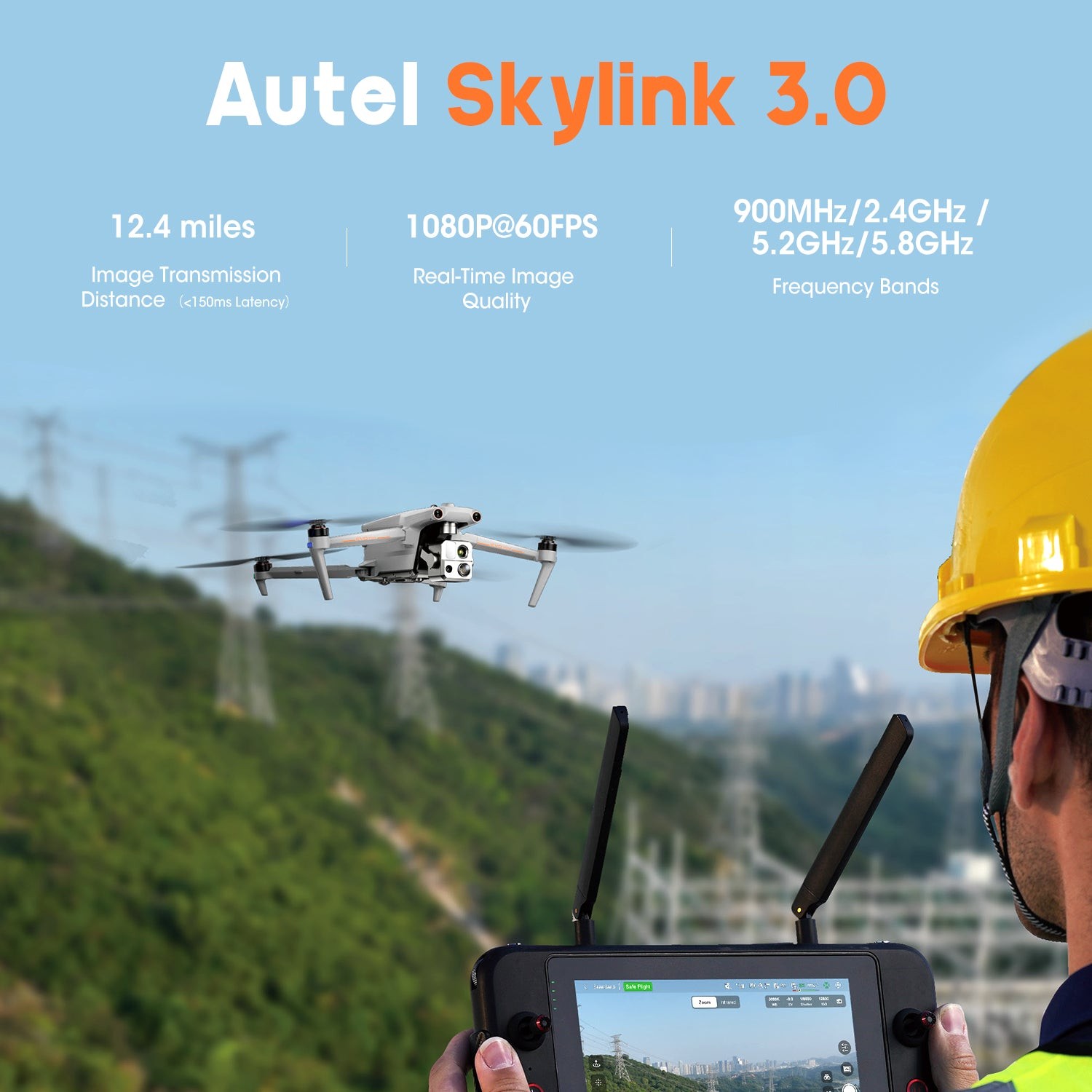
9. Autel SkyLink 3.0
The EVO Max 4T SkyLink 3.0 system comes with 6 antennas, 4 frequency bands, AES-256 encryption, and optional 4G integration to provide users with the most advanced flight capabilities ever in an EVO. This ensures reliable and secure communication over long distances.
9.1 Key Features of SkyLink 3.0
- Image Transmission Distance: 12.4 miles
- Real-Time Image Quality: 1080p/60fps
- Frequency Bands: 900MHz/2.4GHz/5.2GHz/5.8GHz
- Encryption: AES-256
9.2 Benefits of Advanced Communication
The SkyLink 3.0 system ensures that operators have a clear and reliable video feed, even when operating at long distances or in challenging environments. The AES-256 encryption provides secure communication, protecting sensitive data from unauthorized access.
10. Mission-Ready Payload
The EVO Max 4T’s payload integrates a wide-angle camera, zoom camera, thermal camera, and a laser rangefinder for all data capture needs and critical decision-making. This versatile payload allows the drone to be used for a wide range of applications, from detailed inspections to search and rescue operations.
10.1 Camera Specifications
- Wide Camera: 48MP 1/2″ CMOS, Aperture: f/2.8, DFVO: 83.4°, Equivalent: 24 mm
- Zoom Camera: 48MP 10x Optical Zoom, 160x Max. Hybrid Zoom, Aperture: f/2.8-f/4.8
- Thermal Camera: 640×512, Aperture: 9.1mm, 16x Digital Zoom, Temperature Measurement Range: -20°C to 550°C
- Laser Rangefinder: Measuring Range: 5 – 1200m, Measurement Accuracy: +1m
10.2 Applications of the Payload
The EVO Max 4T’s payload is suitable for a wide range of applications, including:
- Infrastructure Inspections: The high-resolution cameras and laser rangefinder allow for detailed inspections of bridges, power lines, and other critical infrastructure.
- Search and Rescue: The thermal camera can detect heat signatures, making it invaluable for locating missing persons in low-light conditions.
- Surveillance: The zoom camera allows for discreet surveillance from a safe distance.
- Mapping and Surveying: The wide-angle camera and laser rangefinder can be used to create accurate 3D maps and models of terrain and structures.
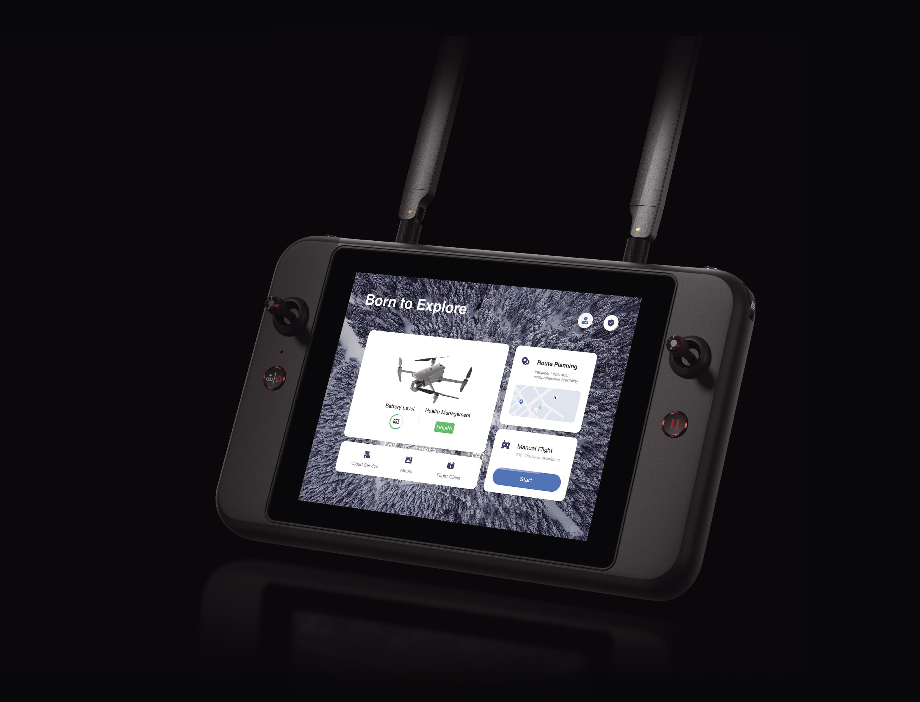
11. Autel Enterprise App Platform
The Autel Enterprise App is built from the ground up for industrial applications and features a brand-new interface for simple, efficient operation. Additional features and semi-autonomous modes maximize the EVO Max 4T’s mission capability, making it easy to plan, execute, and analyze data from drone missions.
11.1 User-Friendly Interface
The Autel Enterprise App features an intuitive interface that simplifies mission planning and execution. The app provides real-time telemetry data, camera controls, and advanced flight planning tools.
11.2 Advanced Features
The app includes a range of advanced features, such as:
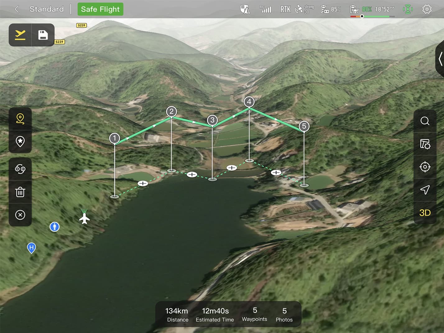
- 3D Map Planning: Plan, create, and execute 3D waypoint mission plans on a 3D map.
- Quick Mission: Temporary quick missions can be created while executing other missions, and multiple sub-missions can be stacked for enhanced flexibility.
- Mission Reproduction: With this feature activated, fly a manual or semi-autonomous mission, or string multiple missions together. The EVO Max 4T will automatically record the camera angles and replicate the mission you just flew.
12. Smart Features
The EVO Max 4T is equipped with a range of smart features that enhance its capabilities and streamline operations. These features include 3D map planning, quick mission planning, and mission reproduction, making it easier to plan and execute complex drone missions.
12.1 3D Map Planning
Plan, create, and execute 3D waypoint mission plans on a 3D map. This feature allows operators to visualize the flight path and ensure that the drone is following the intended route.
12.2 Quick Mission
Temporary quick missions can be created while executing other missions, and multiple sub-missions can be stacked for enhanced flexibility. This feature is useful for responding to unexpected events or changing mission requirements.
12.3 Mission Reproduction
With this feature activated, fly a manual or semi-autonomous mission, or string multiple missions together. The EVO Max 4T will automatically record the camera angles and replicate the mission you just flew. This feature is useful for repetitive tasks, such as inspecting the same structure on a regular basis.
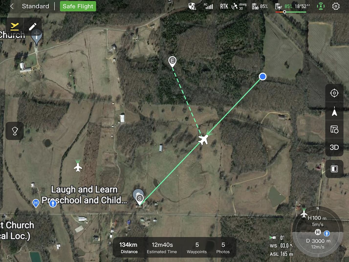
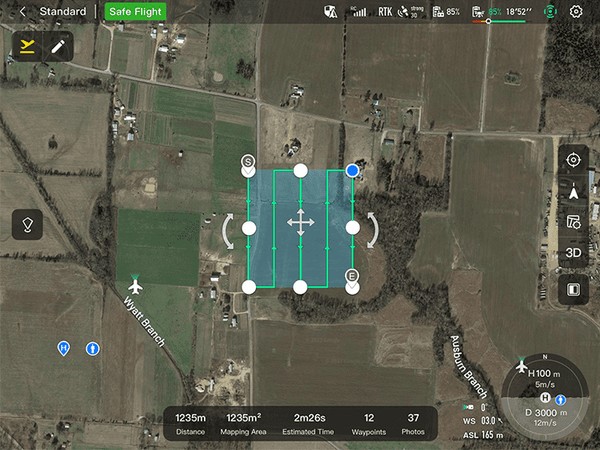
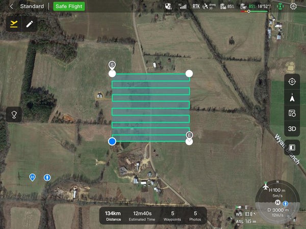
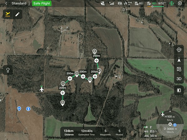
13. Multiple Mission Types
The Enterprise App provides various autonomous and semi-autonomous mission planning options for public safety, inspection, and surveying. These mission types include rectangular missions, automatic mission generation, and waypoint missions, providing operators with the flexibility to adapt to different operational requirements.
13.1 Rectangular Mission
One-click automatic generation of a rectangular flight area, making it easy to survey large areas quickly and efficiently.
13.2 Automatic Mission Generation and Data Capture
Automatically produce routes by adding regional boundary points through dots or importing KML files. This feature simplifies the process of creating complex flight paths and ensures that data is captured consistently.
13.3 Waypoint Missions
Users can add waypoints for flexible, non-structured flight paths, allowing for precise control over the drone’s trajectory.
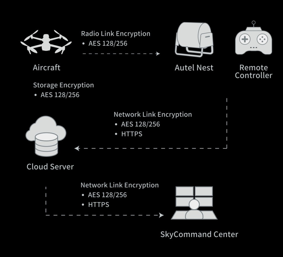
14. Data Security
The EVO Max 4T prioritizes data security with privacy protection and encrypted data storage. Data involving user and aircraft information, including flight logs, locations, and account information, can only be physically accessed via the aircraft locally. It supports AES-256 encryption for photos, videos, and flight logs, which are password-protected.
14.1 Privacy Protection
The EVO Max 4T ensures that user data remains private and secure by restricting access to the aircraft locally. This prevents unauthorized access to sensitive information, such as flight logs and account details.
14.2 Encrypted Data Storage
Supports AES-256 encryption for photos, videos, and flight logs, are password-protected, providing an extra layer of security for sensitive data.
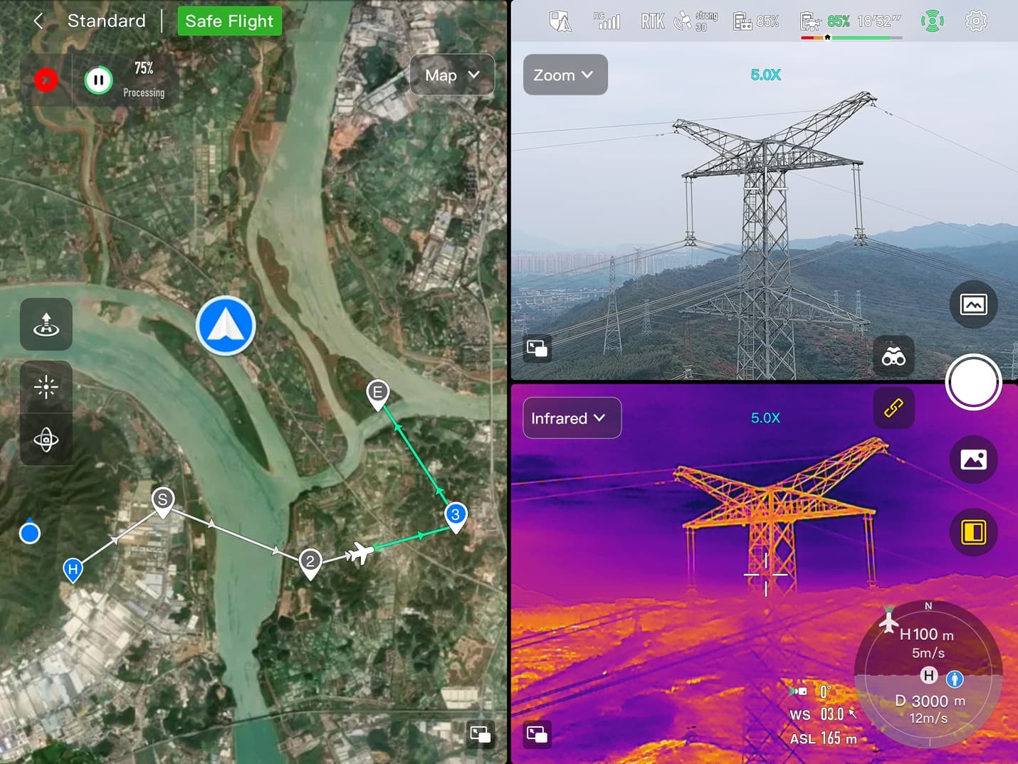
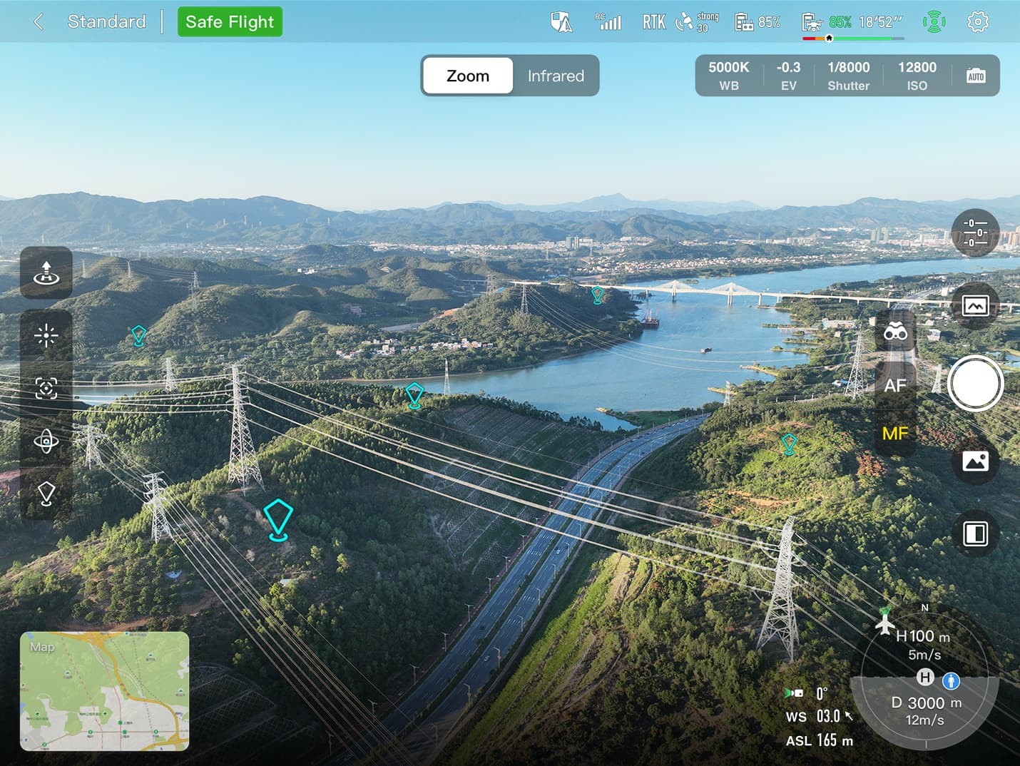
15. Enhanced Live-View
The EVO Max 4T offers an enhanced live-view experience with multi-channel projection and AR scene capabilities. This allows operators to see multiple data streams simultaneously and overlay critical information on the real-time map.
15.1 Multi-Channel Projection Screen
Supports simultaneous output of RGB, infrared, night vision, and wide-angle images, providing operators with a comprehensive view of the environment.
15.2 AR Scene
Geo-location data and other aircraft location info detected by ADS-B can overlay on a real-time map, which is convenient for users to confirm the drone’s location and avoid airborne risks.
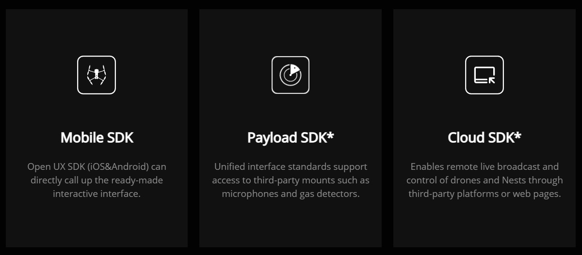
16. Autel SDK
The Autel SDK is open to the world, helping developers and partners reduce software and hardware development costs and jointly create a new industry ecosystem. This allows for customization and integration with other systems, expanding the capabilities of the EVO Max 4T.
16.1 SDK Availability
(Note: Only mobile SDK is available at this moment, other 2 not released yet)
16.2 Benefits of an Open SDK
An open SDK allows developers to create custom applications and integrations that meet specific needs. This can include specialized data processing algorithms, custom user interfaces, and integration with other hardware and software systems.
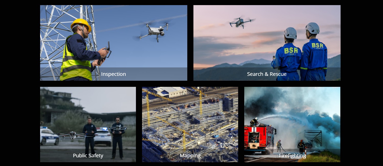
17. Widely Application
The EVO Max 4T is widely applicable across various industries, including:
- Public Safety: Law enforcement, search and rescue, and disaster response.
- Infrastructure Inspection: Bridges, power lines, and telecommunications towers.
- Construction: Site surveying, progress monitoring, and quality control.
- Agriculture: Crop monitoring, irrigation management, and livestock tracking.
- Environmental Monitoring: Wildlife surveys, pollution monitoring, and conservation efforts.
18. Detailed Specifications of Autel EVO Max 4T
To fully understand the capabilities of the Autel EVO Max 4T, it’s essential to delve into its detailed specifications. Below is a comprehensive table outlining the key specifications of this advanced drone.
18.1 Autel EVO Max 4T Detailed Specifications Table
| Feature | Specification |
|---|---|
| Aircraft | |
| Dimensions (Folded) | 476mm x 185mm x 178mm |
| Weight (Takeoff) | 1.99 kg |
| Max Ascent Speed | 8 m/s |
| Max Descent Speed | 6 m/s |
| Max Flight Speed | 23 m/s (75.5 ft/s) |
| Max Flight Time | 42 minutes |
| Max Hover Time | 38 minutes |
| Max Wind Resistance | 27 mph (12 m/s) |
| Operating Frequency | 2.4 GHz, 5.2 GHz, 5.8 GHz, 900MHz |
| Positioning | GPS, GLONASS, BeiDou |
| Operating Temp | -4° to 122°F (-20° to 50°C) |
| IP Rating | IP43 |
| Camera | |
| Wide Camera | 48MP 1/2″ CMOS, f/2.8 aperture, 83.4° DFVO, 24mm equivalent |
| Zoom Camera | 48MP, 10x Optical Zoom, 160x Max. Hybrid Zoom, f/2.8-f/4.8 aperture |
| Thermal Camera | 640×512 resolution, 9.1mm aperture, 16x Digital Zoom, Temperature Measurement Range: -20°C to 550°C |
| Laser Rangefinder | Measuring Range: 5 – 1200m, Measurement Accuracy: +1m |
| Remote Controller | |
| Operating Frequency | 2.4 GHz, 5.2 GHz, 5.8 GHz, 900MHz |
| Transmission Range | 12.4 miles (20 km) |
| Screen Size | 7.9 inches |
| Brightness | 2000 nits |
| Battery Life | 3 hours |
| Obstacle Avoidance | |
| Sensing Range | 0.5 inch |
| Sensing System | Binocular vision, Millimeter Wave Radar |
| A-Mesh 1.0 | |
| Networking | Drone-to-Drone autonomous communication, connection, and collaboration |
| Autel SkyLink 3.0 | |
| Image Transmission | 12.4 miles (20 km) |
| Video Quality | 1080p/60fps |
| Encryption | AES-256 |
| Data Security | |
| Privacy Protection | Local access only |
| Encryption | AES-256 |
| Software | |
| App | Autel Enterprise App |
| SDK | Mobile SDK (available), others pending release |
19. Comparing EVO Max 4T to Competitors
When considering a drone for industrial or commercial use, it’s essential to compare the EVO Max 4T to its competitors. Here’s a detailed comparison to highlight its unique advantages:
19.1 Comparison Table
| Feature | Autel EVO Max 4T | DJI Matrice 300 RTK | Parrot ANAFI USA |
|---|---|---|---|
| Obstacle Avoidance | Binocular Vision + Millimeter Wave Radar (0.5-inch detection) | Binocular Vision | Binocular Vision |
| GPS-Denied Navigation | Advanced Sensors, IMUs, Radar | RTK (Real-Time Kinematic) | Visual Navigation |
| Transmission Range | 12.4 miles (20 km) | 9.3 miles (15 km) | 2 miles (3.2 km) |
| Flight Time | 42 minutes | 55 minutes | 32 minutes |
| Weather Rating | IP43 | IP45 | IP53 |
| Payload Options | Wide, Zoom, Thermal Cameras, Laser Rangefinder | Wide, Zoom, Thermal Cameras, Additional Sensor Ports | Wide, Zoom, Thermal Cameras |
| A-Mesh Technology | Yes (Drone-to-Drone Communication) | No | No |
| Data Security | AES-256 Encryption, Local Data Access Only | AES-256 Encryption | SD Card Encryption |
| SDK Availability | Mobile SDK (available), others pending release | Open SDK | Open SDK |
| Target Applications | Public Safety, Infrastructure Inspection, Surveying, Environmental Monitoring | Surveying, Inspection, Public Safety | Inspection, Public Safety, Reconnaissance |
| Price Range | Higher Tier (Reflects Advanced Features) | High End | Mid-Range |
19.2 Key Takeaways
- Obstacle Avoidance: The EVO Max 4T’s combination of binocular vision and millimeter-wave radar provides superior obstacle avoidance compared to competitors, especially in low-light or adverse weather conditions.
- GPS-Denied Navigation: The EVO Max 4T’s suite of sensors ensures reliable navigation in areas where GPS is unavailable, offering a distinct advantage over RTK-based systems that require external base stations.
- A-Mesh Technology: The A-Mesh system enables drone-to-drone communication, allowing for collaborative missions and extended operational range, a feature not found in competing models.
- Data Security: The EVO Max 4T prioritizes data security with AES-256 encryption and local data access, ensuring sensitive information remains protected.
20. Understanding the Benefits of Choosing Autel EVO Max 4T
The Autel EVO Max 4T offers numerous benefits that make it a standout choice for various applications. Understanding these benefits can help you make an informed decision when choosing a drone for your needs.
20.1 Key Benefits Summarized
- Superior Obstacle Avoidance: The combination of binocular vision and millimeter-wave radar ensures safer and more reliable flights, especially in challenging environments.
- Reliable GPS-Denied Navigation: Advanced sensors enable accurate navigation in areas where GPS is unavailable, expanding operational capabilities.
- Enhanced Communication with A-Mesh: The A-Mesh system allows for drone-to-drone communication, extending the operational range and enabling collaborative missions.
- High-Quality Imaging: The integrated payload includes wide-angle, zoom, and thermal cameras, providing versatile imaging capabilities for various applications.
- Secure Data Handling: AES-256 encryption and local data access ensure that sensitive information remains protected.
- User-Friendly Software: The Autel Enterprise App simplifies mission planning and execution, making it easy to operate the drone and analyze data.
21. How Autel EVO Max 4T Addresses Customer Challenges
The Autel EVO Max 4T is designed to address specific challenges faced by professionals in various industries. By understanding these challenges and how the EVO Max 4T provides solutions, you can better appreciate the value of this advanced drone.
21.1 Addressing Customer Pain Points
- Physical Demands of the Job: The EVO Max 4T reduces the need for manual inspection and data collection, minimizing physical strain on workers.
- Exposure to Hazardous Materials: The drone can operate in hazardous environments, such as chemical plants and disaster zones, keeping workers safe.
- Keeping Up with Technology: The EVO Max 4T is equipped with the latest technologies, such as AI-powered object recognition and autonomous navigation, helping professionals stay ahead of the curve.
- Time Constraints: The drone’s efficient mission planning and execution capabilities save time and resources, allowing professionals to complete tasks more quickly.
- Competition from Other Service Providers: The EVO Max 4T’s advanced features and capabilities provide a competitive edge, enabling professionals to offer superior services.
- Finding Quality Tools: CARDIAGTECH.NET ensures that you have access to high-quality tools and equipment, including the EVO Max 4T, to meet your specific needs.
22. Real-World Applications and Success Stories
The Autel EVO Max 4T has been successfully deployed in various real-world applications, demonstrating its versatility and effectiveness. Here are a few examples:
22.1 Public Safety
Law enforcement agencies have used the EVO Max 4T for surveillance, search and rescue, and disaster response. Its thermal camera and AI-powered object recognition capabilities have been instrumental in locating missing persons and assessing emergency situations.
22.2 Infrastructure Inspection
Utility companies have used the EVO Max 4T to inspect power lines, bridges, and telecommunications towers. Its high-resolution cameras and laser rangefinder have enabled detailed inspections, identifying potential issues before they become major problems.
22.3 Environmental Monitoring
Conservation organizations have used the EVO Max 4T to monitor wildlife populations, track pollution levels, and assess the impact of climate change. Its ability to operate in remote and challenging environments has made it an invaluable tool for environmental research.
23. Tips for Maximizing Your Investment in Autel EVO Max 4T
To ensure you get the most out of your Autel EVO Max 4T, here are some tips for maximizing your investment:
23.1 Best Practices for Drone Operation
- Regular Maintenance: Perform regular maintenance on the drone, including cleaning the sensors and cameras, checking the propellers, and inspecting the battery.
- Software Updates: Keep the drone’s software up to date to ensure you have access to the latest features and security patches.
- Proper Training: Provide proper training to drone operators to ensure they are familiar with the drone’s features and capabilities.
- Compliance with Regulations: Adhere to all relevant regulations and guidelines for drone operation, including airspace restrictions and privacy laws.
23.2 Strategies for Data Management
- Secure Storage: Store data securely, using encryption and password protection to prevent unauthorized access.
- Data Backup: Back up data regularly to prevent data loss in case of equipment failure or other unforeseen events.
- Data Analysis: Use data analysis tools to extract valuable insights from the data collected by the drone.
- Data Sharing: Share data with relevant stakeholders in a secure and efficient manner.
24. Potential ROI and Cost Savings with Autel EVO Max 4T
Investing in the Autel EVO Max 4T can lead to significant returns and cost savings in various applications. Here are some potential areas for ROI and cost savings:
24.1 Quantifiable Benefits
- Reduced Labor Costs: Automating tasks such as inspection and data collection can reduce labor costs significantly.
- Improved Efficiency: The drone’s efficient mission planning and execution capabilities can improve overall efficiency and productivity.
- Enhanced Safety: By operating in hazardous environments, the drone can reduce the risk of injury or death to workers.
- Preventative Maintenance: Identifying potential issues early can prevent costly repairs and downtime.
- Increased Revenue: Offering drone-based services can generate new revenue streams and attract new customers.
24.2 Sample ROI Calculation
| Item | Cost/Savings | Notes |
|---|---|---|
| Labor Cost Savings (per inspection) | $500 | Reduced need for manual labor |
| Time Savings (per inspection) | 4 hours | Faster data collection |
| Preventative Maintenance Savings (annual) | $10,000 | Early detection of issues |
| New Revenue (annual) | $20,000 | Offering drone-based services |
| Total Annual ROI | $30,500 |
25. Addressing Common Concerns About Drone Technology
As with any new technology, there are often concerns about the use of drones. Here are some common concerns and how the Autel EVO Max 4T addresses them:
25.1 Common Concerns and Solutions
- Privacy: The Autel EVO Max 4T includes features such as local data access and encrypted storage to protect sensitive information and ensure compliance with privacy laws.
- Safety: The drone’s advanced obstacle avoidance system and reliable GPS-denied navigation ensure safer flights and reduce the risk of accidents.
- Security: The Autel EVO Max 4T employs AES-256 encryption and other security measures to protect against unauthorized access and