Autel Evo Max 4T is revolutionizing aerial operations with its advanced features and unparalleled autonomy. At CARDIAGTECH.NET, we’re excited to showcase how this drone enhances efficiency, safety, and data accuracy for various industries, making it an indispensable tool for modern professionals. Experience seamless integration with remote sensing technology, high-resolution imaging, and advanced safety features.
1. Understanding the Autel EVO Max 4T: A Comprehensive Overview
The Autel EVO Max 4T stands out as a leader in drone technology, offering a unique blend of powerful capabilities and intelligent features. This advanced unmanned aerial vehicle (UAV) is designed to meet the demanding needs of professionals across various industries, including public safety, infrastructure inspection, and surveying.
The EVO Max 4T distinguishes itself through its superior obstacle avoidance, thanks to the integration of traditional binocular vision systems with millimeter wave radar technology. This combination allows the drone to perceive objects as small as 0.5 inches, eliminating blind spots and enabling safe operation in challenging conditions such as low light or rain.
Adding to its impressive features, the EVO Max 4T is built with a foldable, weather-resistant design, ensuring both portability and durability. This makes it easy to transport and deploy in diverse environments, without compromising on performance. Whether you’re conducting inspections in urban areas or surveying remote locations, the EVO Max 4T is engineered to deliver reliable and accurate results.
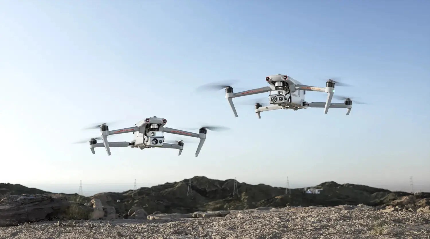 Autel EVO Max 4T drone showcasing its foldable design and advanced sensors
2. Key Features and Benefits of the EVO Max 4T Drone
The Autel EVO Max 4T is packed with features that set it apart from other commercial drones. Its autonomy, advanced sensors, and robust design provide significant benefits for various applications. Let’s explore some of its standout capabilities:
2.1. Superior Obstacle Avoidance
The EVO Max 4T is the only commercial drone that integrates traditional binocular vision systems with millimeter wave radar technology. According to Autel Robotics, this allows the drone to perceive objects down to 0.5 inches, eliminating blind spots. This feature is crucial for safe operation in complex environments and low-light conditions.
2.2. Autonomous Navigation
Equipped with Autel’s Autonomy Engine, the EVO Max 4T collects environmental data and plans 3D flight paths in real-time. This enables autonomous navigation through complex terrains such as mountains, forests, and buildings. Use cases include rapid 3D scene reconstruction, public safety overwatch, and industrial inspections.
2.3. GPS-Denied Environment Navigation
The drone’s advanced sensors allow it to navigate within hardened structures, underground, or in environments without GPS. This capability is essential for indoor inspections and operations in areas where GPS signals are unreliable.
2.4. Accurate Object Identification and Tracking
Based on Autel’s AI recognition technology, the EVO Max 4T can automatically identify and lock onto different types of targets, such as heat sources, moving people, or vehicles. This feature is particularly valuable for law enforcement, search and rescue, and surveillance applications.
2.5. Weather Resistance
With an IP43 ingress protection rating, the EVO Max 4T is protected against solid objects greater than 1mm and sprays of water up to 60 degrees from the vertical. This ensures reliable operation in various weather conditions, making it suitable for outdoor missions.
2.6. Extended Flight Time
The EVO Max 4T offers a maximum flight time of 42 minutes, allowing for extended operation without frequent battery changes. Its hot-swappable battery system further enhances its usability by enabling quick battery replacements in the field.
2.7. Long Transmission Range
The drone boasts an impressive image transmission range of up to 12.4 miles, providing operators with a reliable connection even at long distances. This feature is crucial for applications that require extensive coverage, such as infrastructure inspection and search and rescue.
2.8. A-Mesh Networking
The A-Mesh system enables seamless drone-to-drone communication, connection, and collaboration. Unlike traditional communication chains, this system ensures continuous data relay, even if a single drone fails or disconnects. This enhances the reliability and efficiency of multi-drone operations.
 Close-up view of the Autel EVO Max 4T's advanced obstacle avoidance system
3. Technical Specifications: Delving Into the EVO Max 4T’s Capabilities
To truly appreciate the Autel EVO Max 4T, it’s essential to understand its technical specifications. These details highlight the drone’s capabilities and how it can excel in various professional applications. Here’s a detailed look at its key specifications:
| Feature | Specification |
|---|---|
| Aircraft | |
| Takeoff Weight | 1600 g |
| Wheelbase | 450 mm |
| Dimensions (LWH) | 476x557x170 mm (Unfolded) |
| 335x420x170 mm (Folded) | |
| Max Ascent Speed | 8 m/s |
| Max Descent Speed | 6 m/s |
| Max Horizontal Speed | 23 m/s |
| Max Flight Time | 42 minutes |
| Max Wind Resistance | 12 m/s (Level 6) |
| Operating Temperature | -20°C to 50°C |
| GNSS | GPS, GLONASS, Galileo, BeiDou |
| Sensing System | |
| Obstacle Avoidance | 720° Omnidirectional |
| Sensing Range | 0.5 m to 100 m |
| Camera | |
| Wide Angle Camera | 48 MP, 1/1.28″ CMOS |
| Zoom Camera | 48 MP, 1/2″ CMOS, 10x Optical Zoom, 160x Hybrid Zoom |
| Thermal Camera | 640×512 resolution, 16x Digital Zoom |
| Laser Rangefinder | 5-1200 m range |
| Transmission | |
| Operating Frequency | 2.4 GHz/5.8 GHz |
| Max Transmission Range | 20 km (12.4 miles) |
| Battery | |
| Capacity | 8070 mAh |
| Voltage | 14.88 V |
These specifications showcase the EVO Max 4T’s robust design and advanced technology, making it a versatile tool for a wide range of applications.
4. Real-World Applications: How the EVO Max 4T Enhances Industries
The Autel EVO Max 4T is not just a drone; it’s a versatile tool that enhances operations across various industries. Its advanced features and robust design make it an ideal solution for tasks ranging from infrastructure inspection to public safety. Here are some real-world applications where the EVO Max 4T shines:
4.1. Infrastructure Inspection
The EVO Max 4T excels in infrastructure inspection, providing detailed visual and thermal data for assessing the condition of bridges, power lines, and other critical infrastructure. Its high-resolution cameras and thermal imaging capabilities enable inspectors to identify potential issues such as corrosion, structural damage, and overheating components.
- Bridges: The drone can capture high-resolution images of bridge structures, allowing engineers to identify cracks, spalling, and other signs of deterioration. Thermal imaging can detect areas of moisture intrusion, which can lead to corrosion.
- Power Lines: The EVO Max 4T can inspect power lines for damage, vegetation encroachment, and hot spots. Its zoom camera allows inspectors to identify issues from a safe distance, reducing the risk of accidents.
- Wind Turbines: The drone can perform detailed inspections of wind turbine blades, identifying cracks, delamination, and other defects. This helps ensure the safe and efficient operation of wind farms.
4.2. Public Safety
In public safety, the EVO Max 4T provides valuable aerial support for law enforcement, search and rescue, and firefighting operations. Its AI-powered object identification and tracking capabilities enable first responders to quickly locate and assist individuals in need.
- Search and Rescue: The drone can cover large areas quickly, using its thermal camera to detect body heat and locate missing persons. Its GPS-denied navigation capabilities allow it to operate effectively in dense forests, urban environments, and other challenging terrains.
- Law Enforcement: The EVO Max 4T can provide aerial surveillance for crime scenes, traffic accidents, and other incidents. Its zoom camera allows law enforcement officers to gather evidence and monitor situations from a safe distance.
- Firefighting: The drone can assess fire conditions, identify hotspots, and provide situational awareness to firefighters on the ground. Its thermal imaging capabilities help firefighters locate individuals trapped in burning buildings and assess the structural integrity of affected areas.
4.3. Surveying and Mapping
The EVO Max 4T is a powerful tool for surveying and mapping, allowing professionals to create accurate 3D models and orthomosaics of land and structures. Its autonomous navigation capabilities and high-resolution cameras enable efficient data collection, reducing the time and cost associated with traditional surveying methods.
- Construction Sites: The drone can monitor construction progress, track inventory, and create as-built models. This helps project managers stay on schedule and within budget.
- Mining Operations: The EVO Max 4T can survey mining sites, calculate stockpile volumes, and monitor environmental conditions. This helps mining companies optimize operations and ensure compliance with regulations.
- Agriculture: The drone can assess crop health, monitor irrigation, and identify areas affected by pests or disease. This helps farmers make informed decisions about crop management and improve yields.
4.4. Environmental Monitoring
The EVO Max 4T can be used for environmental monitoring, providing valuable data for assessing air and water quality, tracking wildlife populations, and monitoring deforestation. Its long flight time and high-resolution cameras enable comprehensive data collection over large areas.
- Air Quality Monitoring: The drone can carry sensors to measure air pollutants such as particulate matter, ozone, and nitrogen dioxide. This helps environmental agencies assess air quality and identify sources of pollution.
- Water Quality Monitoring: The EVO Max 4T can collect water samples and carry sensors to measure water quality parameters such as pH, temperature, and dissolved oxygen. This helps environmental agencies monitor water quality and identify sources of pollution.
- Wildlife Monitoring: The drone can track wildlife populations, monitor animal behavior, and assess habitat conditions. Its thermal imaging capabilities allow it to detect animals even in dense vegetation.
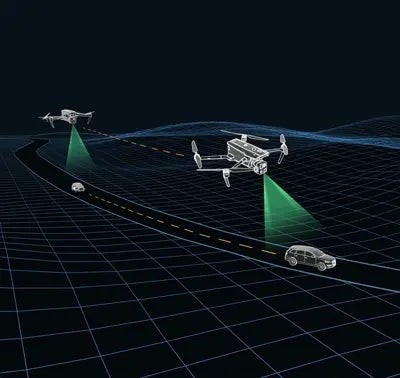 Autel EVO Max 4T conducting an infrastructure inspection of a bridge
5. Understanding Autel Autonomy: The Brains Behind the EVO Max 4T
Autel Autonomy is the advanced technology that powers the Autel EVO Max 4T, enabling it to perform complex tasks with minimal human intervention. This system combines various sensors, algorithms, and AI to provide unparalleled situational awareness and decision-making capabilities. Here’s a closer look at how Autel Autonomy works:
5.1. Sensor Fusion
Autel Autonomy relies on sensor fusion, which combines data from multiple sensors to create a comprehensive understanding of the drone’s environment. The EVO Max 4T is equipped with the following sensors:
- Binocular Vision Systems: These systems use two cameras to create a 3D representation of the environment, allowing the drone to perceive depth and distance.
- Millimeter Wave Radar: This radar technology can detect objects even in low-light or adverse weather conditions. It provides accurate distance measurements and helps the drone avoid obstacles.
- GPS: The Global Positioning System provides the drone with its location and helps it navigate to specific waypoints.
- Inertial Measurement Unit (IMU): The IMU measures the drone’s acceleration and angular velocity, helping it maintain stability and orientation.
5.2. Real-Time 3D Mapping
Autel Autonomy uses the data from these sensors to create a real-time 3D map of the environment. This map is used for obstacle avoidance, path planning, and autonomous navigation. The drone can identify and avoid obstacles as small as 0.5 inches, thanks to the high resolution of its sensors and the advanced algorithms that process the data.
5.3. AI-Powered Decision-Making
Autel Autonomy incorporates AI algorithms that enable the drone to make intelligent decisions based on its understanding of the environment. These algorithms are used for:
- Object Recognition: The drone can identify and classify objects such as people, vehicles, and buildings. This is useful for applications such as search and rescue, surveillance, and traffic monitoring.
- Path Planning: The drone can plan optimal flight paths to reach its destination while avoiding obstacles and adhering to safety regulations.
- Adaptive Control: The drone can adapt its flight parameters based on environmental conditions such as wind speed and direction.
5.4. Autonomous Flight Modes
Autel Autonomy enables the EVO Max 4T to perform various autonomous flight modes, including:
- Waypoint Navigation: The drone can fly to a series of waypoints, automatically capturing images and videos along the way.
- Orbit Mode: The drone can orbit around a point of interest, keeping the camera focused on the target.
- Terrain Following: The drone can maintain a constant altitude above the ground, even in hilly or mountainous terrain.
- Obstacle Avoidance: The drone can automatically avoid obstacles in its path, ensuring safe operation in complex environments.
 Diagram illustrating how Autel Autonomy combines sensor data for 3D mapping and decision-making
6. Navigating GPS-Denied Environments: The EVO Max 4T’s Edge
One of the most impressive features of the Autel EVO Max 4T is its ability to navigate in GPS-denied environments. This capability is crucial for applications where GPS signals are unreliable or unavailable, such as indoor inspections, underground operations, and urban environments with tall buildings. Here’s how the EVO Max 4T achieves GPS-denied navigation:
6.1. Advanced Sensor Suite
The EVO Max 4T is equipped with a suite of advanced sensors that enable it to navigate without GPS. These sensors include:
- Inertial Measurement Unit (IMU): The IMU measures the drone’s acceleration and angular velocity, providing data for estimating its position and orientation.
- Vision Sensors: The binocular vision systems create a 3D representation of the environment, allowing the drone to perceive its surroundings and avoid obstacles.
- Millimeter Wave Radar: The radar technology provides accurate distance measurements, even in low-light or adverse weather conditions.
6.2. Simultaneous Localization and Mapping (SLAM)
The EVO Max 4T uses Simultaneous Localization and Mapping (SLAM) algorithms to create a map of its environment while simultaneously estimating its position within that map. SLAM algorithms use the data from the drone’s sensors to identify features in the environment and track their movement over time. This allows the drone to build a map of its surroundings and estimate its position even without GPS.
6.3. Visual-Inertial Odometry (VIO)
Visual-Inertial Odometry (VIO) is another technique used by the EVO Max 4T to navigate in GPS-denied environments. VIO combines data from the drone’s vision sensors and IMU to estimate its motion. The vision sensors provide information about the drone’s position and orientation relative to its surroundings, while the IMU provides data about its acceleration and angular velocity. By combining these two sources of information, VIO can accurately estimate the drone’s motion even without GPS.
6.4. Applications in GPS-Denied Environments
The EVO Max 4T’s ability to navigate in GPS-denied environments opens up a wide range of applications:
- Indoor Inspections: The drone can perform inspections of warehouses, factories, and other indoor spaces without relying on GPS.
- Underground Operations: The EVO Max 4T can be used for surveying mines, tunnels, and other underground environments.
- Urban Environments: The drone can navigate in urban environments with tall buildings, where GPS signals are often blocked or reflected.
- Search and Rescue: The EVO Max 4T can be used for search and rescue operations in dense forests, urban environments, and other areas where GPS signals are unreliable.
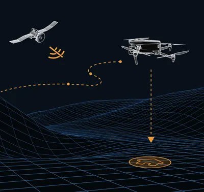 Autel EVO Max 4T navigating in a GPS-denied environment, showcasing its advanced sensors
7. EVO Max 4T’s Superior Infrared Capabilities: Chase the Heat, Explore the Night
The Autel EVO Max 4T offers exceptional infrared capabilities, making it a valuable tool for applications that require thermal imaging. Its advanced thermal camera and intelligent features allow operators to “chase the heat” and explore the night, providing valuable insights in low-light or no-light conditions. Here’s a closer look at the EVO Max 4T’s infrared capabilities:
7.1. High-Resolution Thermal Camera
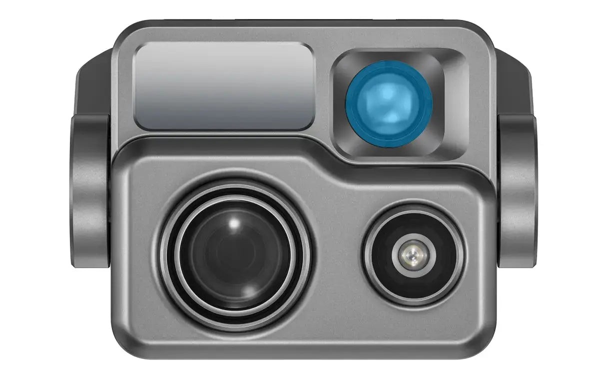
The EVO Max 4T is equipped with a high-resolution thermal camera that captures detailed thermal images and videos. The camera has a resolution of 640×512, allowing it to detect subtle temperature differences and identify heat sources from a distance.
7.2. Super Zoom Capabilities
The EVO Max 4T’s zoom camera supports 8K 10x continuous optical zoom and a maximum hybrid zoom of up to 160x. This allows operators to zoom in on distant objects and identify heat signatures from up to 2 kilometers away. This feature is particularly useful for applications such as energy inspections, emergency rescue, and public safety.
7.3. Super-Sensitive Imaging
The EVO Max 4T can record up to 4K 30p extreme low-light videos, with ISO reaching up to 64000. This allows it to capture target details even in moonlight conditions. For photography, the drone supports intelligent hardware multi-frame noise reduction and HDR fusion technology, ensuring delicate and clear photos in low-light environments.
7.4. Precision Ranging
The EVO Max 4T features one-click pinpoint positioning, enabling rapid acquisition of target location. The maximum ranging distance is up to 1.2 kilometers, allowing operators to quickly locate and assess heat sources from a safe distance.
7.5. Applications of Infrared Capabilities
The EVO Max 4T’s superior infrared capabilities make it suitable for a wide range of applications:
- Search and Rescue: The drone can be used to locate missing persons in low-light or no-light conditions. The thermal camera can detect body heat, even in dense vegetation or rubble.
- Firefighting: The EVO Max 4T can assess fire conditions, identify hotspots, and provide situational awareness to firefighters on the ground. The thermal camera can penetrate smoke and identify individuals trapped in burning buildings.
- Energy Inspections: The drone can inspect power lines, solar panels, and other energy infrastructure for overheating components. The thermal camera can identify hot spots that indicate potential failures or inefficiencies.
- Law Enforcement: The EVO Max 4T can be used for surveillance and reconnaissance in low-light conditions. The thermal camera can detect individuals and vehicles even in complete darkness.
 Thermal image captured by the Autel EVO Max 4T, showcasing its heat detection capabilities
8. Hot-Swappable Battery: Maximizing Uptime with the EVO Max 4T
The Autel EVO Max 4T features a hot-swappable battery system, which allows for extended flight times without the need for downtime. This system enables users to easily swap out batteries while the drone is still in operation, making it ideal for use in time-critical applications where every second counts. Here’s a closer look at the benefits of the EVO Max 4T’s hot-swappable battery system:
8.1. Continuous Operation
With a hot-swappable battery system, the EVO Max 4T can remain in operation for extended periods, without the need to land and power down the drone. This is particularly useful for applications such as search and rescue, surveillance, and infrastructure inspection, where continuous data collection is essential.
8.2. Reduced Downtime
The hot-swappable battery system significantly reduces downtime, as operators can quickly swap out batteries in the field without interrupting the mission. This minimizes the amount of time the drone is out of operation, allowing for more efficient data collection.
8.3. Increased Productivity
By minimizing downtime and allowing for continuous operation, the hot-swappable battery system increases productivity. Operators can collect more data in less time, making the EVO Max 4T a more efficient tool for various applications.
8.4. Battery Specifications
The Autel EVO Max 4T uses a high-capacity LiPo 4S battery with the following specifications:
- Capacity: 8070 mAh
- Voltage: 14.88V
- Energy: 120wh
- Net Weight: 520g
8.5. How to Hot-Swap the Battery
To hot-swap the battery on the EVO Max 4T, follow these steps:
- Ensure the drone is hovering or landed safely.
- Locate the battery compartment on the drone.
- Open the battery compartment and carefully remove the depleted battery.
- Insert the fully charged battery into the compartment.
- Close the battery compartment.
- The drone will continue its operation without interruption.
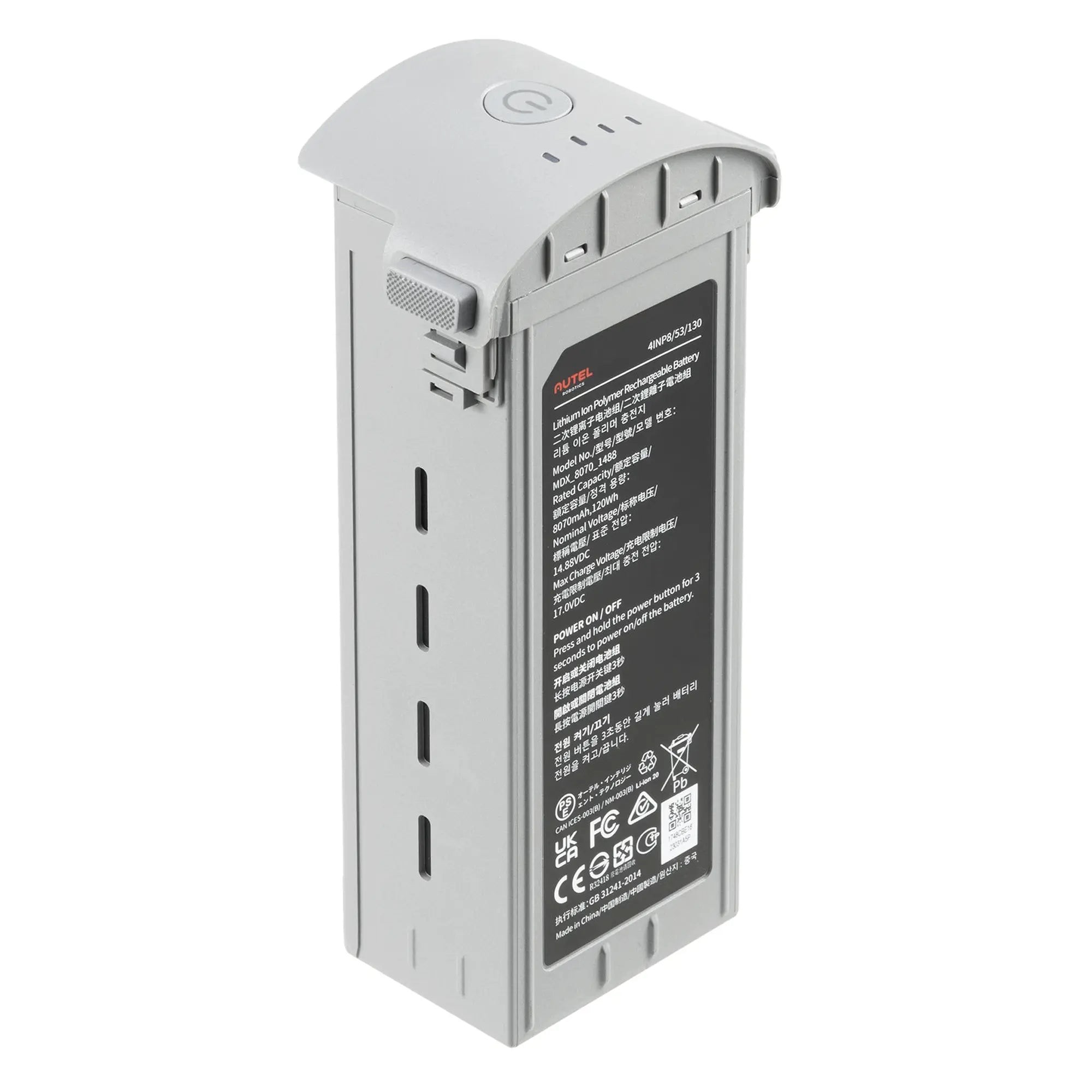 Close-up of the Autel EVO Max 4T's hot-swappable battery, emphasizing its easy replacement
9. A-Mesh Networking: Collaborative Drone Operations with EVO Max 4T
The Autel EVO Max 4T introduces the innovative A-Mesh system, enabling seamless drone-to-drone autonomous communication, connection, and collaboration. Unlike traditional communication chains, the system ensures continuous data relay, even if a single drone fails or disconnects, thanks to its strong anti-interference capabilities. Here’s a detailed look at the A-Mesh networking solution:
9.1. Seamless Communication
The A-Mesh system allows multiple EVO Max 4T drones to communicate with each other autonomously, without relying on a central controller. This enables collaborative operations, where drones can share data, coordinate their movements, and work together to achieve a common goal.
9.2. Continuous Data Relay
In traditional communication chains, the failure of a single drone can disrupt the entire network. The A-Mesh system overcomes this limitation by ensuring continuous data relay, even if a drone fails or disconnects. The remaining drones in the network can automatically reroute the data, ensuring that it reaches its destination.
9.3. Strong Anti-Interference Capabilities
The A-Mesh system is designed to operate in challenging environments with strong radio interference. It uses advanced communication protocols and frequency hopping techniques to minimize the impact of interference and maintain a reliable connection between drones.
9.4. Zonal Operations
The EVO Max 4T supports dual-drone dual-control to achieve zonal operations of aircraft, improving flight work efficiency. It also supports mutual obstacle avoidance among drones within the network, ensuring flight operation safety.
9.5. Information Sharing
The two remote controllers within the network can simultaneously monitor the aircraft footage. The AI target recognition feature used in the lead controller can also be displayed on the member controller. Additionally, both controllers can utilize the pinpoint positioning feature.
9.6. Relay Operations
In scenarios with signal obstructions or weak signals such as crossing hills or remote areas, the aircraft can be quickly deployed as a mobile relay communication node, providing reliable signal support for another member aircraft at a distance, efficiently expanding the communication coverage area.
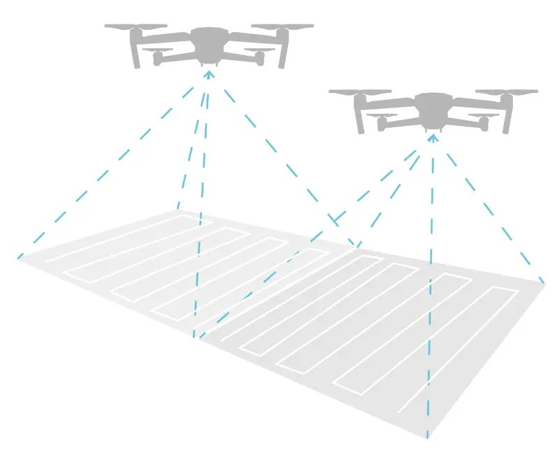 Diagram illustrating the A-Mesh networking system, showcasing drone-to-drone communication
10. Autel SkyLink 3.0: The Backbone of EVO Max 4T’s Connectivity
The Autel EVO Max 4T utilizes the SkyLink 3.0 system, a highly advanced drone communication technology, offering impressive specifications for enhanced flight performance. This system ensures a reliable and high-quality connection between the drone and the remote controller, even at long distances. Here’s a summary of its key features:
10.1. Long Transmission Distance
The SkyLink 3.0 system boasts an impressive image transmission distance of up to 12.4 miles. This allows operators to maintain a stable connection with the drone even when it is far away, making it ideal for applications such as infrastructure inspection, search and rescue, and surveillance.
10.2. Low Latency
The SkyLink 3.0 system is designed to minimize latency, ensuring that operators receive real-time feedback from the drone. This is crucial for applications that require precise control, such as piloting in complex environments or tracking moving targets.
10.3. High-Quality Image Transmission
The SkyLink 3.0 system supports 1080p/60fps real-time image quality, providing operators with a clear and detailed view of the drone’s surroundings. This is essential for applications that require accurate visual data, such as infrastructure inspection and environmental monitoring.
10.4. Multiple Frequency Bands
The SkyLink 3.0 system supports multiple frequency bands, including 900MHz, 2.4GHz, 5.2GHz, and 5.8GHz. This allows it to operate in a wide range of environments and minimize the impact of interference.
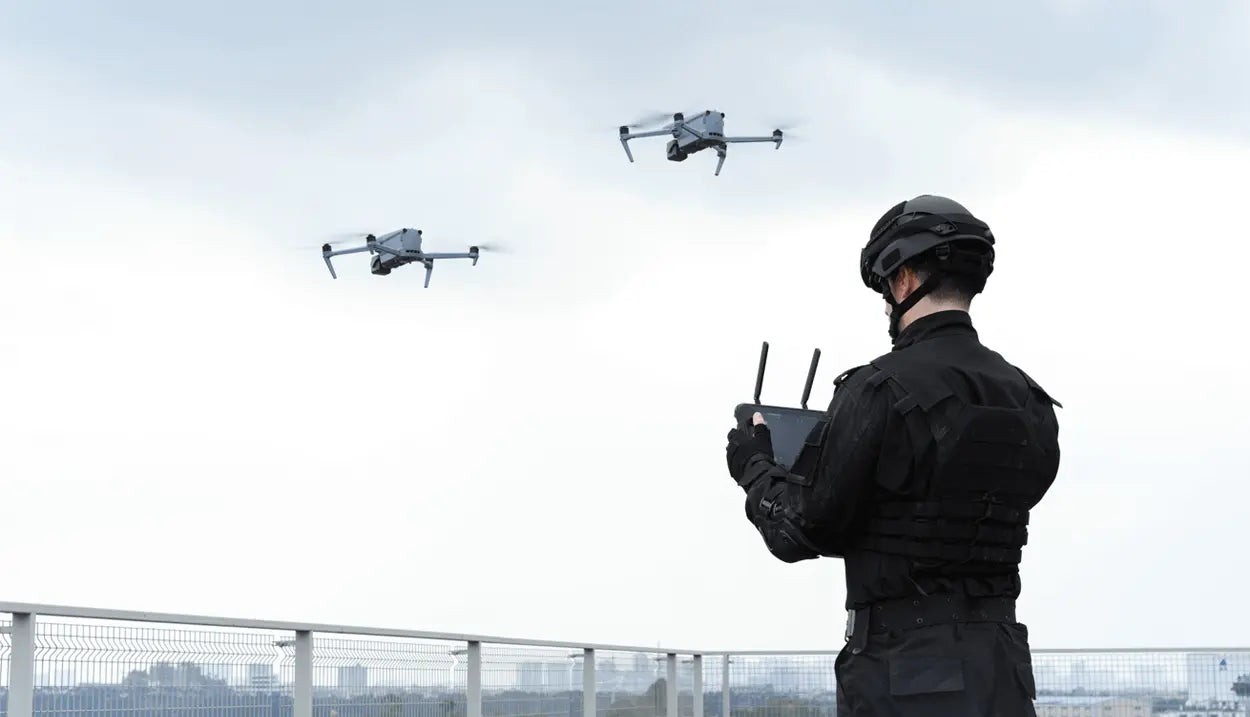 Illustration of the Autel SkyLink 3.0 system, highlighting its long transmission range
11. Smart Features of the Autel EVO Max 4T
The Autel EVO Max 4T is equipped with a range of smart features that enhance its usability and efficiency. These features automate various tasks, allowing operators to focus on the mission at hand. Here are some of the key smart features of the EVO Max 4T:
11.1. 3D Map Planning
The EVO Max 4T allows operators to plan, create, and execute 3D waypoint missions on a 3D map. This feature is useful for applications such as surveying and mapping, where accurate and repeatable flight paths are essential.
11.2. Quick Mission
Temporary quick missions can be created while executing other missions, and multiple sub-missions can be stacked for enhanced flexibility. This allows operators to quickly adapt to changing conditions and address unexpected challenges.
11.3. Mission Reproduction
With this feature activated, operators can fly a manual or semi-autonomous mission, or string multiple missions together. The EVO Max 4T will automatically record the camera angles and replicate the mission that was just flown. This is useful for applications such as infrastructure inspection, where consistent data collection is essential.
12. EVO Max 4T’s Versatile Mission Types: Tailoring to Your Needs
The Autel EVO Max 4T offers a variety of mission types, allowing operators to tailor the drone’s operation to their specific needs. These mission types include automatic mission generation, polygon missions, and waypoint missions. Here’s a closer look at each of these mission types:
12.1. Automatic Mission Generation
The EVO Max 4T can automatically produce routes by adding regional boundary points through dots or importing KML files. This is useful for applications such as surveying and mapping, where the drone needs to cover a large area efficiently.
12.2. Polygon Mission
The EVO Max 4T supports one-click automatic generation of polygon flight areas. This allows operators to quickly define the area they want to survey or inspect, without having to manually create a flight path.
12.3. Waypoint Missions
The EVO Max 4T allows users to add waypoints for flexible, non-structured flight paths. This is useful for applications such as infrastructure inspection, where the drone needs to follow a specific path to inspect a structure.
13. Data Security: Protecting Your Information with Autel EVO Max 4T
Data security is a top priority for Autel Robotics, and the EVO Max 4T is designed to protect user information from unauthorized access. The drone incorporates various security features, including privacy protection and encrypted data storage. Here’s a closer look at these security features:
13.1. Privacy Protection
Data involving user and aircraft information, including flight logs, locations, and account information can only be physically accessed via the aircraft locally. This ensures that sensitive information remains private and secure.
13.2. Encrypted Data Storage
The EVO Max 4T supports AES-256 encryption for photos, videos, and flight logs, which are password-protected. This prevents unauthorized access to the drone’s data, even if the drone is lost or stolen.
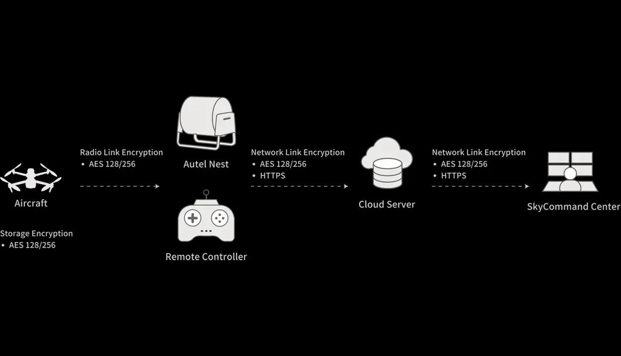 Autel EVO Max 4T, highlighting its data security features
14. Autel SDK: Unleashing the Potential of the EVO Max 4T
The Autel SDK (Software Development Kit) is open to the world, helping developers and partners reduce software and hardware development costs and jointly create a new industry ecosystem. The SDK allows developers to create custom applications and integrations that extend the capabilities of the EVO Max 4T. Here’s a closer look at the Autel SDK:
14.1. Mobile SDK
The Mobile SDK includes an Open UX SDK (iOS/Android) that can directly call up the ready-made interactive interface. This allows developers to quickly create custom mobile apps for controlling the drone, processing data, and integrating with other systems.
15. Accessories for Autel EVO Max 4T
To enhance the functionality and versatility of your Autel EVO Max 4T, a range of accessories is available. These accessories can help you optimize your drone for various applications and ensure that you have the equipment you need to get the job done.
Some popular accessories for the Autel EVO Max 4T include:
- Extra Batteries: Having extra batteries on hand can extend your flight time and minimize downtime.
- Battery Charging Hub: A battery charging hub allows you to charge multiple batteries simultaneously, ensuring that you always have a fully charged battery ready to go.
- Propellers: Spare propellers are essential for maintaining your drone’s performance and ensuring safe flight.
- Carrying Case: A carrying case protects your drone during transport and storage.
16. Package List: What’s Included with Your EVO Max 4T
When you purchase an Autel EVO Max 4T, you’ll receive a comprehensive package that includes everything you need to get started. The package typically includes:
- Autel EVO Max 4T Aircraft
- Remote Controller
- Batteries
- Charger
- Propellers
- Cables
- Carrying Case
17. Why Choose CARDIAGTECH.NET for Your Autel EVO Max 4T?
At CARDIAGTECH.NET, we understand the challenges faced by automotive professionals. The physical demands, exposure to hazardous materials, and the constant need to update skills can be overwhelming. That’s why we offer the Autel EVO Max 4T – to enhance your efficiency, accuracy, and safety.
Facing challenges like:
- Demanding physical tasks?
- Exposure to harmful substances?
- Keeping up with the latest automotive technology?
- Time constraints and competition?
- Finding quality tools that meet your needs?
CARDIAGTECH.NET can help you:
- Enhance job efficiency and reduce repair times.
- Increase accuracy and safety.
- Save costs on repairs and maintenance.
- Boost revenue and profitability.
- Improve your reputation and service quality.
Ready to elevate your automotive services? Contact CARDIAGTECH.NET today for a consultation on how the Autel EVO Max 4T can transform your operations.
Contact Information:
- Address: 276 Reock St, City of Orange, NJ 07050, United States
- WhatsApp: +1 (641) 206-8880
- Website: CARDIAGTECH.NET
18. Frequently Asked Questions (FAQ) About the Autel EVO Max 4T
Q1: What is the flight time of the Autel EVO Max 4T?
A1: The Autel EVO Max 4T has a maximum flight time of 42 minutes.
Q2: What is the transmission range of the Autel EVO Max 4T?
A2: The Autel EVO Max 4T has a transmission range of up to 12.4 miles.
Q3: Does the Autel EVO Max 4T have obstacle avoidance?
A3: Yes, the Autel EVO Max 4T has 720° omnidirectional obstacle avoidance.
Q4: Can the Autel EVO Max 4T fly in GPS-denied environments?
A4: Yes, the Autel EVO Max 4T can navigate in GPS-denied environments using its advanced sensors and algorithms.
Q5: What is the resolution of the Autel EVO Max 4T’s thermal camera?
A5: The Autel EVO Max 4T’s thermal camera has a resolution of 640×512.
Q6: Does the Autel EVO Max 4T have a hot-swappable battery?
A6: Yes, the Autel EVO Max 4T has a hot-swappable battery system, allowing for extended flight times without downtime.
Q7: What is the IP rating of the Autel EVO Max 4T?
A7: The Autel EVO Max 4T has an IP43 rating, meaning it is protected against solid objects greater than 1mm and sprays of water up to 60 degrees from the vertical.
Q8: Does the Autel EVO Max 4T support A-Mesh networking?
A8: Yes, the Autel EVO Max 4T supports A-Mesh networking, enabling seamless drone-to-drone communication and collaboration.
Q9: What is the operating frequency of the Autel EVO Max 4T?
A9: The Autel EVO Max 4T operates on the 2.4 GHz/5.8 GHz frequency bands.
Q10: Does CARDIAGTECH.NET offer support for the Autel EVO Max 4T?
A10: Yes, CARDIAGTECH.NET provides comprehensive support for the Autel EVO Max 4T, including product information, technical assistance, and training resources. Contact us today to learn more.
