
The Autel 4n Drone is a groundbreaking tool, blending advanced aerial technology with practical applications for various industries and offering innovative solutions for nighttime operations, thermal imaging, and precise data collection. Explore its features and potential benefits at CARDIAGTECH.NET. Discover how this unmanned aerial vehicle (UAV) excels in starlight conditions, GPS-denied environments, and obstacle avoidance.
1. Introduction to the Autel EVO Max 4N Drone
The Autel EVO Max 4N drone stands as a pinnacle of innovation in the realm of unmanned aerial vehicles. Designed with cutting-edge technology and robust features, it’s engineered to meet the rigorous demands of various professional applications. This advanced drone not only pushes the boundaries of aerial capabilities but also redefines operational efficiency and data accuracy.
This drone is not just another addition to the market; it is a comprehensive solution designed to enhance productivity and precision in industries such as:
- Public Safety: Enhancing surveillance and emergency response with real-time data and thermal imaging.
- Industrial Inspection: Providing detailed visual and thermal inspections of infrastructure, ensuring safety and efficiency.
- Land Surveying: Offering precise mapping and surveying capabilities, improving accuracy and reducing time.
- Search and Rescue: Equipped with night vision and thermal capabilities to find people in need.
The Autel EVO Max 4N is the ideal tool for professionals seeking to improve operational capabilities, enhance data collection, and ensure reliability in demanding environments.
2. Key Features and Specifications of the Autel 4N Drone
The Autel EVO Max 4N drone boasts a comprehensive suite of features and specifications that set it apart as a leader in the commercial drone market. Each element is meticulously designed to enhance performance, reliability, and operational versatility. Here’s an in-depth look at its key attributes:
2.1. Starlight Night Vision Camera
The starlight night vision camera is a standout feature, enabling the drone to operate in extremely low-light conditions, down to 0.0001 Lux. This capability makes it ideal for nighttime surveillance, search and rescue operations, and other tasks requiring superior visibility in the dark.
2.2. Advanced Obstacle Avoidance System
Equipped with 720-degree obstacle avoidance, the Autel EVO Max 4N integrates traditional binocular vision systems with millimeter wave radar technology. This advanced system detects objects as small as 0.5 inches, minimizing blind spots and ensuring safe operation in complex environments.
2.3. A-Mesh 1.0 Networking
The A-Mesh 1.0 system enables drone-to-drone autonomous communication, connection, and collaboration. This mesh networking technology allows multiple drones to communicate seamlessly, enhancing operational efficiency and coverage, especially in beyond visual line of sight (BVLOS) applications.
2.4. SkyLink 3.0 Transmission System
The SkyLink 3.0 system features six antennas, four frequency bands, AES-256 encryption, and optional 4G integration. It provides a robust and reliable communication link, ensuring stable image transmission over distances up to 12.4 miles with low latency and 1080p/60fps real-time image quality.
2.5. Autonomous Path Finding
Powered by Autel’s advanced Autonomy Engine, the EVO Max 4N collects environmental data and plans 3D flight paths through complex environments. This feature is essential for rapid 3D scene reconstruction, industrial inspections, and land surveying.
2.6. GPS-Denied Navigation
Advanced sensors enable the Autel EVO Max 4N to navigate in environments without GPS, such as within hardened structures or underground. This capability expands its utility in areas where traditional GPS navigation is unavailable.
2.7. Accurate Object Identification and Tracking
Utilizing Autel’s AI recognition technology, the drone automatically identifies and locks onto various targets, including heat sources, moving people, or vehicles. This feature is critical for high-altitude tracking and data collection in law enforcement and surveillance applications.
2.8. IP43 Weather Rating
The IP43 rating ensures the drone is protected against solid objects greater than 1mm in diameter and sprays of water up to 60 degrees from the vertical. This durability enhances its reliability in challenging weather conditions.
2.9. Hot-Swappable Battery System
The hot-swappable battery system allows for extended flight times without downtime. Operators can easily swap batteries during operations, ensuring continuous performance in time-critical applications.
2.10. Payload Capabilities
The integrated payload includes a wide-angle camera, zoom camera, thermal camera, and laser rangefinder. These components cater to all data capture needs, enabling informed decision-making in various operational scenarios.
- Wide Camera: 50MP, 1/1.28″ CMOS sensor
- Zoom Camera: Up to 8x zoom, supporting linkage zoom
- Thermal Camera: 640×512 resolution, temperature measurement range from -4℉ to 1022℉
- Laser Rangefinder: Measuring range of 5m to 1.2km with high accuracy
3. Real-World Applications of the Autel EVO Max 4N
The Autel EVO Max 4N drone is not just a piece of technology; it’s a versatile solution with applications across numerous industries. Its advanced features make it an invaluable asset for professionals seeking to improve efficiency, accuracy, and safety. Here are some real-world applications where the Autel EVO Max 4N excels:
3.1. Public Safety and Law Enforcement
In public safety, the Autel EVO Max 4N enhances surveillance and emergency response efforts. Its starlight night vision camera and thermal imaging capabilities allow law enforcement to conduct nighttime patrols, search for missing persons, and monitor crime scenes effectively.
- Search and Rescue: Thermal imaging helps locate individuals in difficult conditions.
- Surveillance: High-resolution cameras provide detailed monitoring of public areas.
- Incident Response: Real-time data transmission aids in coordinating emergency responses.
3.2. Industrial Inspections
The drone’s ability to navigate complex environments and capture high-resolution imagery makes it perfect for industrial inspections. It can inspect infrastructure such as power lines, bridges, and cell towers, identifying potential issues before they become major problems.
- Power Line Inspections: Detect anomalies and prevent outages.
- Bridge Inspections: Assess structural integrity and safety.
- Cell Tower Inspections: Ensure optimal performance and maintenance.
3.3. Land Surveying and Mapping
With its precise GPS-denied navigation and autonomous path finding, the Autel EVO Max 4N is ideal for land surveying and mapping. It can create accurate 3D models of terrain, providing valuable data for urban planning, construction, and environmental monitoring.
- Topographic Surveys: Generate detailed maps of land surfaces.
- Construction Planning: Assist in the design and layout of construction projects.
- Environmental Monitoring: Track changes in landscapes and ecosystems.
3.4. Agriculture
In agriculture, the drone can be used to monitor crop health, assess irrigation needs, and optimize fertilizer application. Its high-resolution cameras capture detailed images of fields, allowing farmers to make data-driven decisions that improve yields and reduce costs.
- Crop Monitoring: Identify areas of stress and disease.
- Irrigation Assessment: Determine water needs and optimize irrigation schedules.
- Fertilizer Optimization: Apply fertilizers precisely to maximize effectiveness.
3.5. Construction and Infrastructure
The Autel EVO Max 4N is invaluable for construction and infrastructure projects. It can monitor progress, inspect structures, and ensure safety on construction sites.
- Progress Monitoring: Track the status of construction projects in real-time.
- Safety Inspections: Identify potential hazards and ensure compliance with safety regulations.
- Structural Analysis: Assess the integrity of buildings and infrastructure.
3.6. Environmental Monitoring and Conservation
The Autel EVO Max 4N plays a vital role in environmental monitoring and conservation efforts. Its high-resolution cameras and thermal imaging capabilities can monitor wildlife populations, track deforestation, and assess the impact of pollution on ecosystems.
- Wildlife Monitoring: Track animal populations and behaviors.
- Deforestation Tracking: Monitor changes in forest cover.
- Pollution Assessment: Evaluate the impact of pollutants on ecosystems.
4. Enhanced Performance in Low-Light Conditions
One of the most impressive features of the Autel EVO Max 4N drone is its exceptional performance in low-light conditions. This capability sets it apart from many other drones on the market, making it an invaluable tool for nighttime operations.
4.1. Starlight Camera Technology
The drone is equipped with a starlight camera that can operate in lighting conditions as low as 0.0001 Lux. This means it can capture clear, detailed images even in near-total darkness. This is achieved through a combination of advanced sensor technology, image processing algorithms, and high-quality optics.
4.2. Applications of Low-Light Performance
The ability to perform in low light opens up a wide range of applications for the Autel EVO Max 4N:
- Nighttime Surveillance: Monitor areas in complete darkness without the need for additional lighting.
- Search and Rescue: Locate missing persons in challenging conditions, such as dense forests or remote areas.
- Infrastructure Inspection: Inspect critical infrastructure at night, reducing downtime and minimizing disruptions.
- Environmental Monitoring: Study nocturnal wildlife and track environmental changes under the cover of darkness.
4.3. Comparison with Traditional Methods
Traditional methods of nighttime surveillance and inspection often rely on artificial lighting, which can be disruptive and costly. The Autel EVO Max 4N eliminates the need for additional lighting, reducing energy consumption and minimizing disturbance to the environment.
4.4. Benefits of Starlight Night Vision
The starlight night vision camera provides several key benefits:
- Enhanced Visibility: Capture clear images in extremely low-light conditions.
- Reduced Costs: Eliminate the need for artificial lighting.
- Increased Safety: Operate safely in dark environments with enhanced visibility.
- Minimal Disruption: Conduct operations without disturbing the surrounding environment.
5. Navigating GPS-Denied Environments with the Autel 4N Drone
The Autel EVO Max 4N drone is engineered to excel even in environments where GPS signals are unreliable or unavailable. This capability is crucial for missions in urban canyons, indoors, or near structures that interfere with GPS signals.
5.1. Advanced Sensor Technology
The drone utilizes advanced sensor technology, including inertial measurement units (IMUs), visual sensors, and radar, to navigate without GPS. These sensors provide real-time data on the drone’s position, orientation, and velocity, allowing it to maintain stable flight and accurate positioning.
5.2. Visual Positioning System (VPS)
The Visual Positioning System (VPS) uses cameras to analyze the surrounding environment and create a 3D map. This map is then used to estimate the drone’s position and navigate through the environment.
5.3. Radar Technology
Radar technology provides additional information about the drone’s surroundings, even in low-light or obscured conditions. This helps the drone avoid obstacles and maintain its position accurately.
5.4. Applications in GPS-Denied Environments
The ability to navigate without GPS expands the range of applications for the Autel EVO Max 4N:
- Indoor Inspections: Inspect buildings, warehouses, and other indoor spaces without relying on GPS signals.
- Underground Operations: Conduct inspections and surveys in mines, tunnels, and other underground environments.
- Urban Environments: Navigate through dense urban areas where tall buildings interfere with GPS signals.
5.5. Benefits of GPS-Denied Navigation
The ability to navigate without GPS provides several key benefits:
- Increased Reliability: Operate reliably in environments where GPS signals are unavailable.
- Expanded Applications: Conduct missions in a wider range of environments.
- Enhanced Safety: Avoid obstacles and maintain stable flight in challenging conditions.
6. Autonomous Capabilities and Intelligent Flight Modes
The Autel EVO Max 4N is equipped with a range of autonomous capabilities and intelligent flight modes that enhance its operational efficiency and safety. These features allow the drone to perform complex tasks with minimal human intervention, reducing the workload on the pilot and improving the quality of data collected.
6.1. Autonomous Path Finding
Powered by Autel’s advanced Autonomy Engine, the drone can collect environmental data and plan 3D flight paths through complex environments. This feature is essential for rapid 3D scene reconstruction, industrial inspections, and land surveying.
6.2. Object Identification and Tracking
The drone uses Autel’s AI recognition technology to automatically identify and lock onto various targets, including heat sources, moving people, or vehicles. This feature is critical for high-altitude tracking and data collection in law enforcement and surveillance applications.
6.3. Intelligent Flight Modes
The Autel EVO Max 4N offers a range of intelligent flight modes that simplify complex tasks:
- Waypoint Navigation: Plan and execute flight paths with multiple waypoints.
- Orbit Mode: Circle around a specific point of interest, capturing smooth, cinematic footage.
- Follow Me Mode: Automatically follow a moving subject, keeping it centered in the frame.
- Terrain Follow Mode: Maintain a constant altitude above the ground, even in uneven terrain.
6.4. Benefits of Autonomous Capabilities
The autonomous capabilities of the Autel EVO Max 4N provide several key benefits:
- Increased Efficiency: Perform complex tasks with minimal human intervention.
- Enhanced Safety: Reduce the risk of human error and improve flight stability.
- Improved Data Quality: Collect consistent and accurate data with automated flight paths.
6.5. Applications of Intelligent Flight Modes
The intelligent flight modes expand the range of applications for the Autel EVO Max 4N:
- Inspection: Conduct detailed inspections of infrastructure with automated flight paths.
- Surveying: Create accurate 3D models of terrain with automated data collection.
- Filming: Capture professional-quality footage with cinematic flight modes.
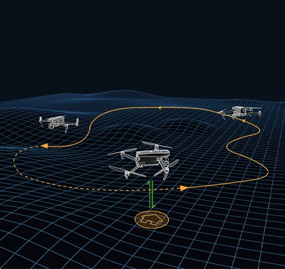
7. A-Mesh 1.0: Drone-to-Drone Communication and Collaboration
The Autel EVO Max 4N features A-Mesh 1.0, a revolutionary technology that enables drone-to-drone autonomous communication, connection, and collaboration. This mesh networking system enhances operational efficiency, expands coverage, and improves reliability in various applications.
7.1. How A-Mesh 1.0 Works
A-Mesh 1.0 allows multiple drones to communicate seamlessly, creating a self-organizing network. If one drone fails or exits unexpectedly, the system independently reorganizes and continues to relay critical information. This ensures continuous operation and minimizes disruptions.
7.2. Key Features of A-Mesh 1.0
- Autonomous Communication: Drones communicate directly with each other without relying on a central control station.
- Self-Organizing Network: The network automatically adjusts to changes in the environment or the addition/removal of drones.
- Extended Range: Multiple drones act as relay points, extending the communication range beyond visual line of sight (BVLOS).
- Full-Fleet Control: A single pilot can control multiple drones autonomously or a group of pilots can work simultaneously.
7.3. Applications of A-Mesh 1.0
The A-Mesh 1.0 system expands the range of applications for the Autel EVO Max 4N:
- Search and Rescue: Coordinate multiple drones to search large areas efficiently.
- Environmental Monitoring: Monitor ecosystems over a wide area with coordinated data collection.
- Infrastructure Inspection: Inspect extensive infrastructure networks with multiple drones working together.
7.4. Benefits of A-Mesh 1.0
The A-Mesh 1.0 system provides several key benefits:
- Increased Efficiency: Coordinate multiple drones to perform tasks more quickly and efficiently.
- Extended Coverage: Expand the operational range beyond visual line of sight (BVLOS).
- Improved Reliability: Ensure continuous operation even if one drone fails.
- Enhanced Collaboration: Enable multiple pilots to work together seamlessly.
7.5. Case Studies
Real-world case studies demonstrate the effectiveness of A-Mesh 1.0 in various applications. For example, search and rescue teams have used the system to coordinate multiple drones in the search for missing persons, significantly reducing search times and improving the chances of a successful rescue.
8. The Autel SkyLink 3.0 Transmission System
The Autel EVO Max 4N utilizes the SkyLink 3.0 transmission system, providing a robust and reliable communication link between the drone and the remote controller. This advanced system ensures stable image transmission over long distances, even in challenging environments.
8.1. Key Features of SkyLink 3.0
- Long-Range Transmission: Transmit images and data up to 12.4 miles.
- Low Latency: Minimize delays between the drone and the remote controller.
- High-Quality Image Transmission: Transmit real-time images at 1080p/60fps.
- Multi-Frequency Bands: Operate on 900MHz, 2.4GHz, 5.2GHz, and 5.8GHz frequency bands to avoid interference.
- AES-256 Encryption: Secure data transmission with advanced encryption technology.
- Optional 4G Integration: Integrate with 4G networks for enhanced connectivity.
8.2. Benefits of SkyLink 3.0
The SkyLink 3.0 system provides several key benefits:
- Increased Range: Operate the drone over long distances without losing connection.
- Improved Stability: Maintain a stable connection even in challenging environments.
- Enhanced Security: Protect data with advanced encryption technology.
- Real-Time Data: Access real-time images and data for informed decision-making.
8.3. Applications of SkyLink 3.0
The SkyLink 3.0 system expands the range of applications for the Autel EVO Max 4N:
- Infrastructure Inspection: Inspect remote infrastructure networks with a stable, long-range connection.
- Environmental Monitoring: Monitor ecosystems over a wide area with real-time data transmission.
- Public Safety: Coordinate emergency responses with a reliable communication link.
8.4. Comparison with Traditional Transmission Systems
Traditional transmission systems often suffer from limited range, unstable connections, and security vulnerabilities. The SkyLink 3.0 system addresses these issues with its long-range transmission, stable connection, and advanced encryption technology.
8.5. Real-World Performance
In real-world tests, the SkyLink 3.0 system has demonstrated exceptional performance in challenging environments. It has maintained a stable connection over long distances, even in areas with electromagnetic interference.
9. Data Security and Privacy Features
The Autel EVO Max 4N is designed with robust data security and privacy features to protect sensitive information. These features are essential for applications in law enforcement, government, and other sectors where data security is paramount.
9.1. Key Security Features
- Data Encryption: Encrypt photos, videos, and flight logs with AES-256 encryption.
- Password Protection: Protect data with password-protected access controls.
- Physical Data Access: Limit physical access to user and aircraft information, ensuring data remains secure on the device.
- No Cloud Storage: Store data locally without relying on cloud storage, reducing the risk of data breaches.
9.2. Benefits of Data Security Features
The data security features of the Autel EVO Max 4N provide several key benefits:
- Data Protection: Protect sensitive information from unauthorized access.
- Privacy Compliance: Comply with privacy regulations and protect user data.
- Risk Reduction: Reduce the risk of data breaches and cyberattacks.
- Peace of Mind: Ensure data remains secure and confidential.
9.3. Applications of Data Security Features
The data security features of the Autel EVO Max 4N are essential for various applications:
- Law Enforcement: Protect sensitive data collected during surveillance and investigations.
- Government: Secure data related to critical infrastructure and national security.
- Industrial Inspections: Protect proprietary information about industrial facilities and processes.
- Environmental Monitoring: Secure data about sensitive ecosystems and wildlife populations.
9.4. Comparison with Other Drones
Many other drones rely on cloud storage and lack robust data encryption, making them vulnerable to data breaches. The Autel EVO Max 4N stands out with its comprehensive data security features and commitment to protecting user privacy.
9.5. Compliance with Regulations
The Autel EVO Max 4N complies with relevant data security regulations, ensuring that users can operate the drone with confidence and peace of mind.
10. Autel Enterprise App Platform: Enhancing Mission Capabilities
The Autel Enterprise App is specifically designed for industrial applications, providing a streamlined interface and enhanced usability. This app maximizes the Autel EVO Max 4N’s mission capabilities, enabling efficient and effective operation in various scenarios.
10.1. Key Features of the Enterprise App
- Intuitive Interface: Streamlined design for easy navigation and operation.
- Additional Features: Enhanced functionalities for industrial applications.
- Semi-Autonomous Modes: Intelligent flight modes for automated tasks.
- 3D Map Planning: Plan, create, and execute 3D waypoint missions on a 3D map.
- Quick Mission: Create temporary quick missions while executing other missions.
- Mission Reproduction: Automatically record camera angles and replicate missions.
10.2. Benefits of the Enterprise App
The Autel Enterprise App provides several key benefits:
- Increased Efficiency: Streamline operations and perform tasks more quickly.
- Enhanced Usability: Simplify complex tasks with an intuitive interface.
- Improved Data Quality: Collect consistent and accurate data with automated flight paths.
- Expanded Capabilities: Unlock additional features and functionalities for industrial applications.
10.3. Applications of the Enterprise App
The Autel Enterprise App is essential for various applications:
- Industrial Inspections: Plan and execute detailed inspections with automated flight paths.
- Land Surveying: Create accurate 3D models of terrain with automated data collection.
- Public Safety: Coordinate emergency responses with enhanced communication and data sharing.
- Environmental Monitoring: Monitor ecosystems over a wide area with coordinated data collection.
10.4. Comparison with Standard Drone Apps
Standard drone apps often lack the advanced features and functionalities required for industrial applications. The Autel Enterprise App is specifically designed to meet the needs of professional users, providing a comprehensive solution for mission planning, execution, and data analysis.
10.5. User Testimonials
Users praise the Autel Enterprise App for its intuitive interface, powerful features, and reliable performance. Many users report significant improvements in efficiency and data quality after switching to the Enterprise App.
11. Accessories and Additional Equipment
To maximize the potential of the Autel EVO Max 4N, consider investing in additional accessories and equipment. These enhancements can improve performance, extend flight times, and provide specialized capabilities.
11.1. Autel Smart Controller V3
The Autel Smart Controller V3 features a daylight-readable display with 2000nit maximum brightness, a 2048×1536 resolution, and a 7.9-inch screen. It also offers super download speeds, a functional interface with HDMI ports, ultra-long battery life, and built-in 128G storage space.
11.2. EVO Nest
The EVO Nest is a base for automatic take-off, landing, charging, and mission planning for the Autel EVO series. It’s designed for all-weather operation and uses a single-piece protective drum to simplify maintenance.
11.3. RTK Module
The RTK Module provides centimeter-accurate positioning data for mapping and reduces electromagnetic interference for flying near critical structures.
11.4. Additional Batteries
Having extra batteries on hand allows for extended flight times without downtime. The Autel EVO Max 4N features a hot-swappable battery system, making it easy to swap batteries during operations.
11.5. Other Accessories
- Propeller Guards: Protect the propellers from damage during flight.
- Landing Gear Extensions: Provide additional ground clearance for landing in rough terrain.
- Carrying Case: Protect the drone and accessories during transport.
11.6. Benefits of Accessories
Investing in accessories can significantly enhance the performance and versatility of the Autel EVO Max 4N:
- Increased Productivity: Extend flight times and minimize downtime.
- Enhanced Safety: Protect the drone from damage and improve flight stability.
- Expanded Capabilities: Unlock additional features and functionalities.
12. Purchasing Your Autel 4N Drone from CARDIAGTECH.NET
When you’re ready to acquire your Autel EVO Max 4N drone, CARDIAGTECH.NET offers a seamless and reliable purchasing experience. Here’s why you should choose CARDIAGTECH.NET for your drone needs:
12.1. Wide Selection of Products
CARDIAGTECH.NET offers a wide selection of Autel drones, accessories, and equipment. You can find everything you need to get started with your drone operations in one convenient location.
12.2. Competitive Pricing
CARDIAGTECH.NET offers competitive pricing on all Autel products. You can be sure you’re getting the best value for your money.
12.3. Expert Support
CARDIAGTECH.NET provides expert support to help you choose the right drone and accessories for your needs. Their knowledgeable staff can answer your questions and provide guidance on drone operations.
12.4. Secure Online Ordering
CARDIAGTECH.NET offers a secure online ordering system to protect your personal and financial information. You can shop with confidence, knowing your data is safe.
12.5. Fast Shipping
CARDIAGTECH.NET provides fast shipping to get your drone and accessories to you as quickly as possible. You can start using your new equipment right away.
12.6. Customer Satisfaction Guarantee
CARDIAGTECH.NET is committed to customer satisfaction. If you’re not happy with your purchase, they’ll work with you to make it right.
12.7. How to Purchase
Purchasing your Autel EVO Max 4N from CARDIAGTECH.NET is easy. Simply visit their website, browse the selection of products, and add the items you want to your cart. Then, proceed to checkout and follow the instructions to complete your order.
13. FAQs About the Autel EVO Max 4N Drone
Here are some frequently asked questions about the Autel EVO Max 4N drone:
-
What is the flight time of the Autel EVO Max 4N?
The Autel EVO Max 4N has a maximum flight time of up to 42 minutes.
-
What is the transmission range of the Autel EVO Max 4N?
The transmission range of the Autel EVO Max 4N is up to 12.4 miles.
-
Does the Autel EVO Max 4N have obstacle avoidance?
Yes, the Autel EVO Max 4N has 720-degree obstacle avoidance.
-
Can the Autel EVO Max 4N fly in GPS-denied environments?
Yes, the Autel EVO Max 4N can navigate in GPS-denied environments using advanced sensor technology.
-
What is the weather rating of the Autel EVO Max 4N?
The Autel EVO Max 4N has an IP43 weather rating, protecting it from solid objects and sprays of water.
-
Does the Autel EVO Max 4N have a thermal camera?
Yes, the Autel EVO Max 4N has a thermal camera with a resolution of 640×512.
-
What is A-Mesh 1.0?
A-Mesh 1.0 is a technology that enables drone-to-drone autonomous communication, connection, and collaboration.
-
How secure is the data on the Autel EVO Max 4N?
The Autel EVO Max 4N offers robust data security features, including AES-256 encryption and password protection.
-
What is the Autel Enterprise App?
The Autel Enterprise App is specifically designed for industrial applications, providing a streamlined interface and enhanced usability.
-
Where can I purchase the Autel EVO Max 4N?
You can purchase the Autel EVO Max 4N from CARDIAGTECH.NET.
14. Contact CARDIAGTECH.NET Today
Ready to elevate your operations with the Autel EVO Max 4N? Contact CARDIAGTECH.NET today to learn more and make your purchase. Our team of experts is here to help you choose the right drone and accessories for your needs. We offer competitive pricing, expert support, and fast shipping. Don’t wait – enhance your capabilities with the Autel EVO Max 4N from CARDIAGTECH.NET today.
Contact Information:
- Address: 276 Reock St, City of Orange, NJ 07050, United States
- WhatsApp: +1 (641) 206-8880
- Website: CARDIAGTECH.NET
Take your business to new heights with the Autel EVO Max 4N and CARDIAGTECH.NET. We are here to provide tools that improve efficiency, accuracy, and safety. Contact us now to get started!